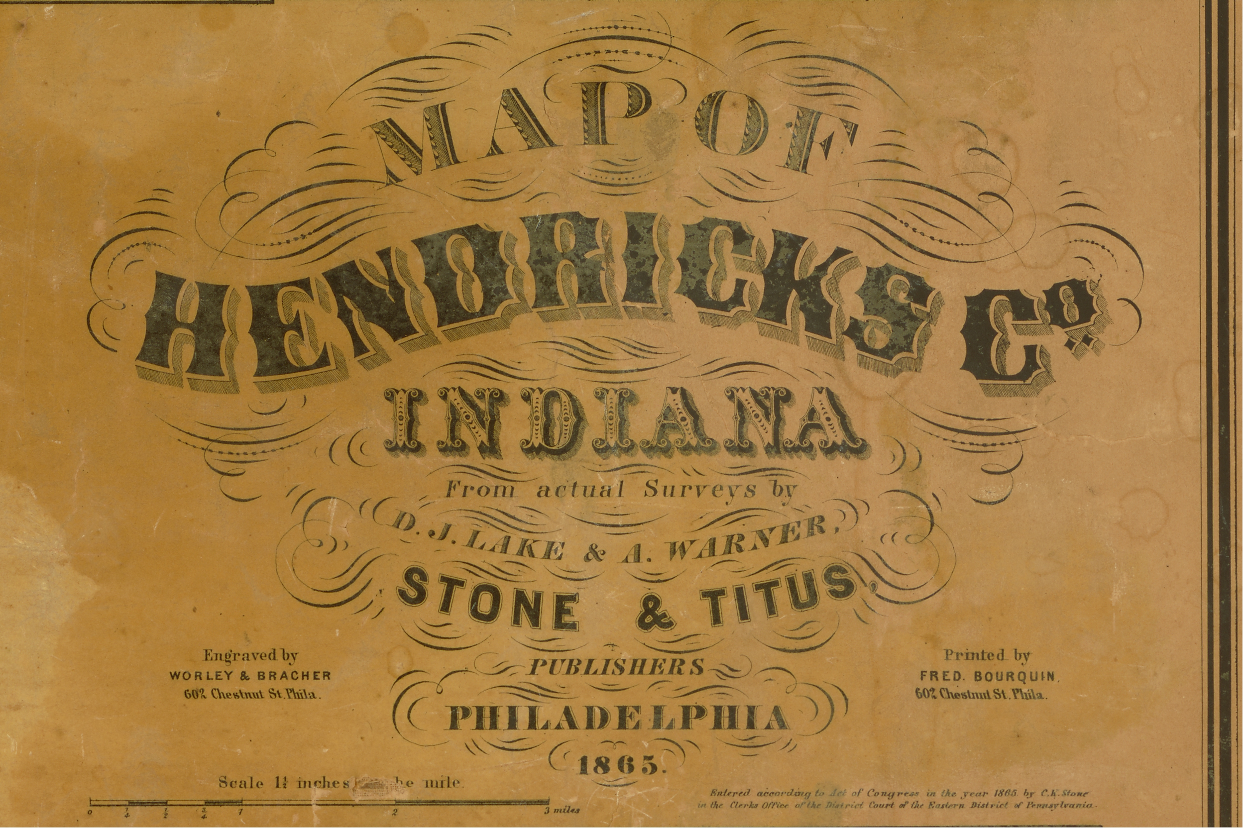
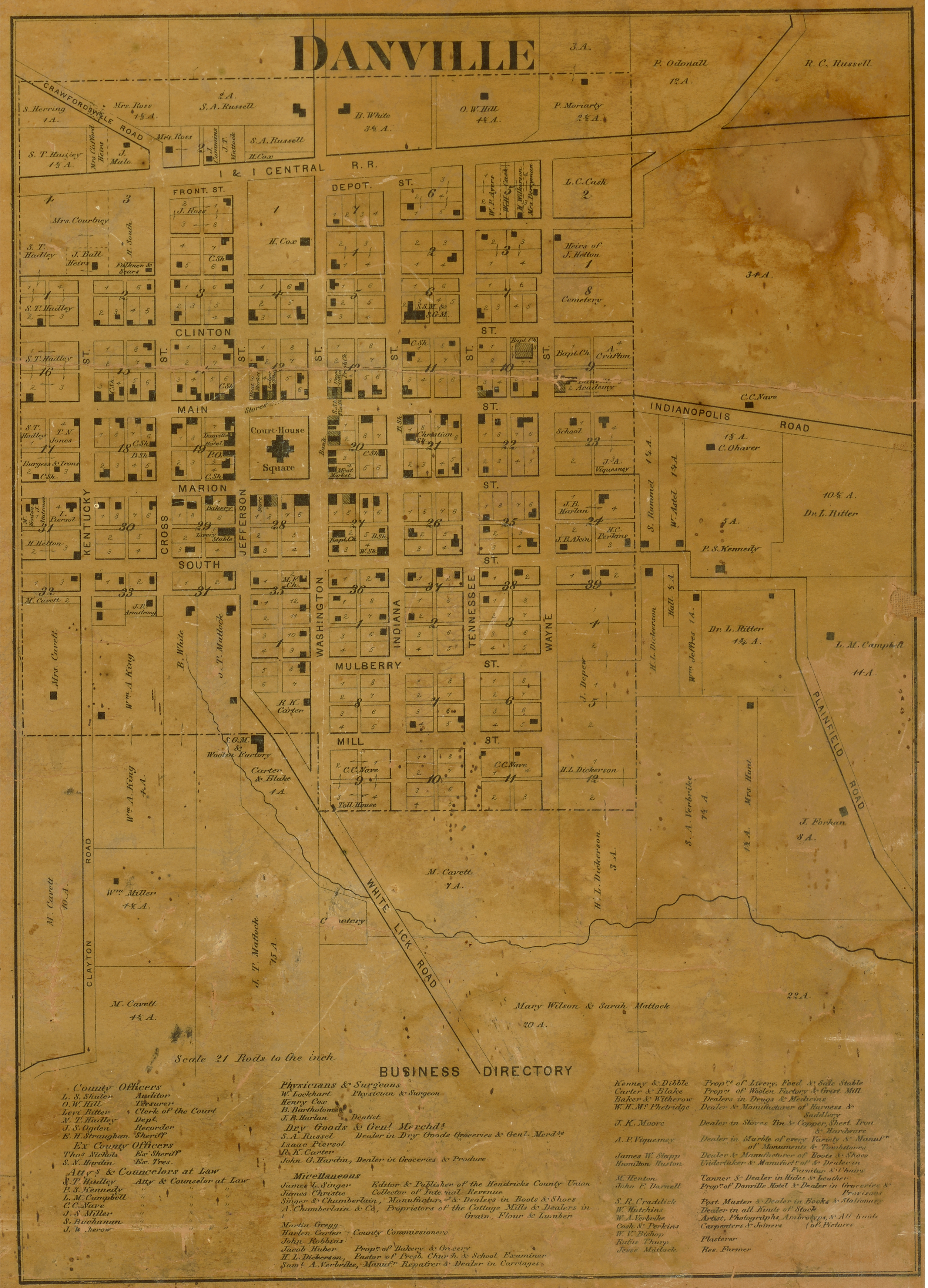
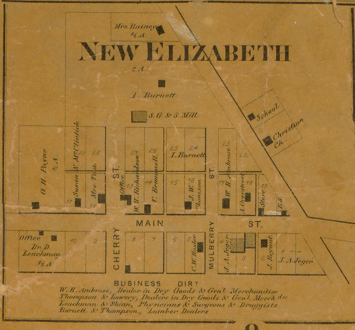
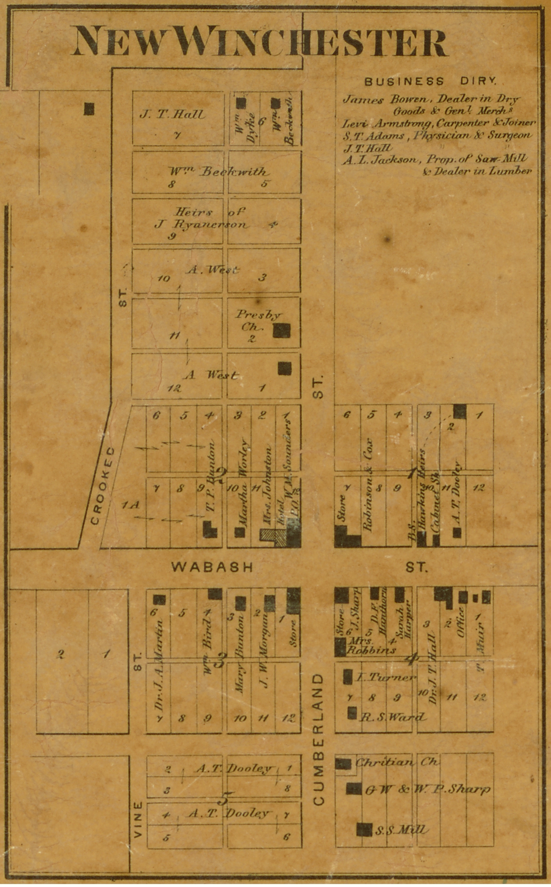
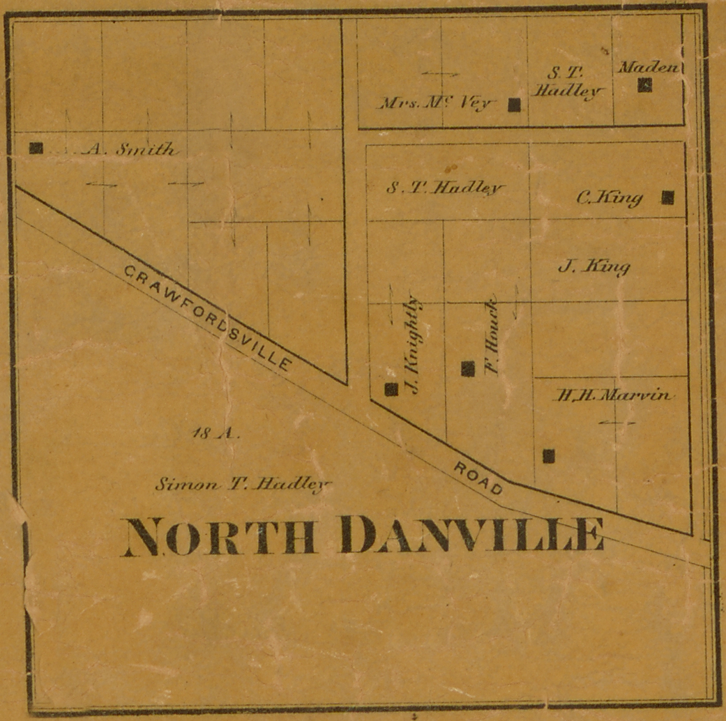
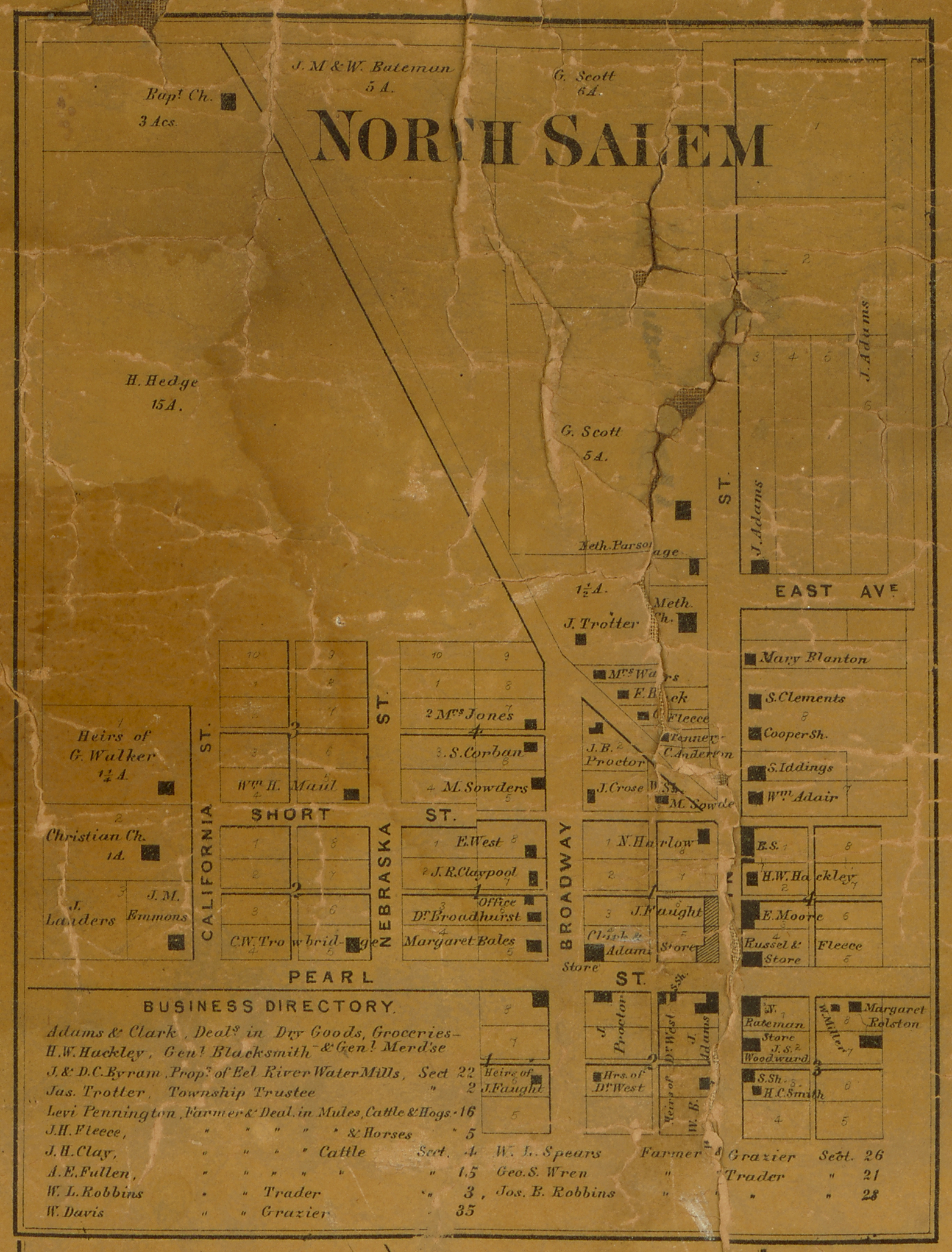
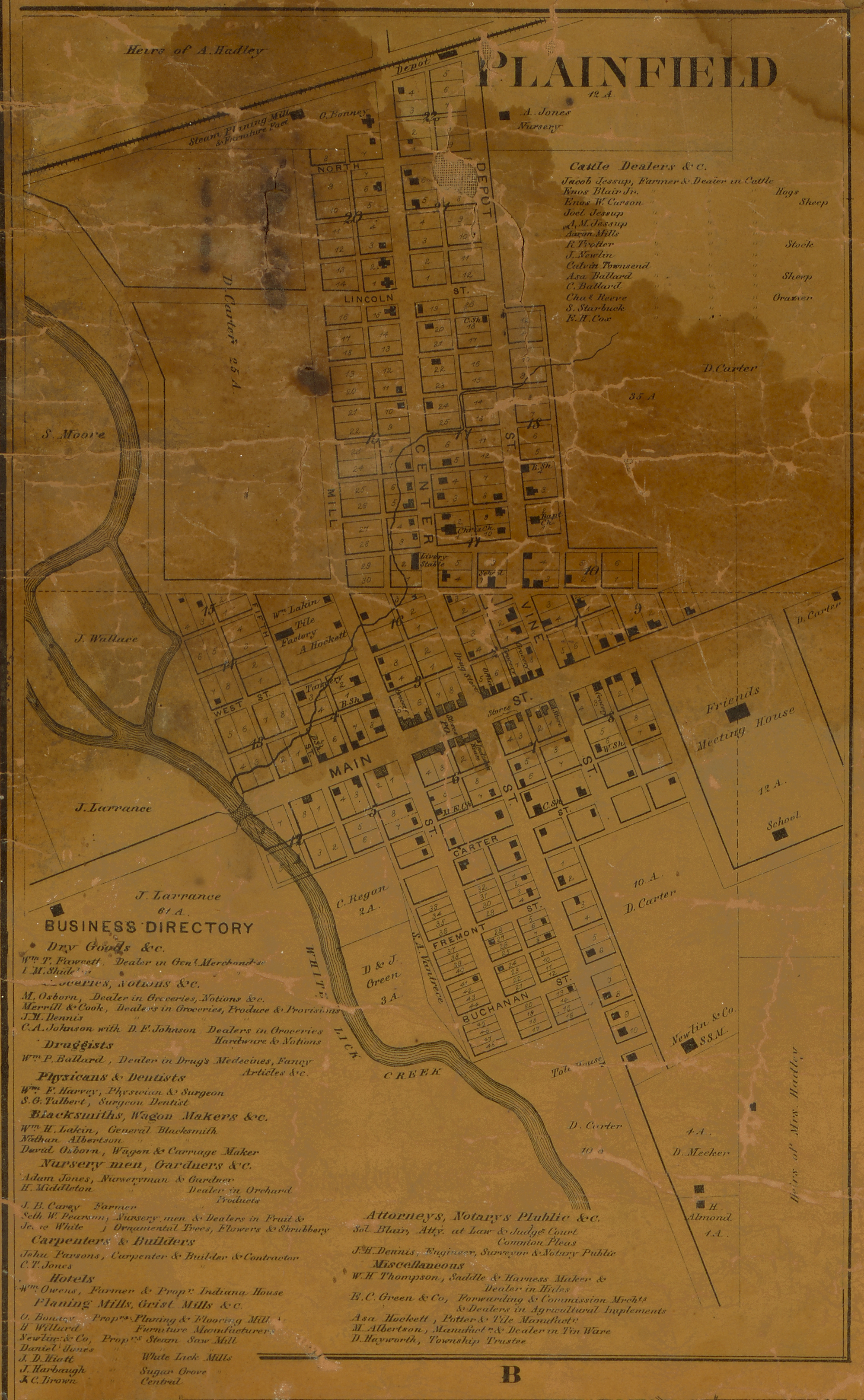
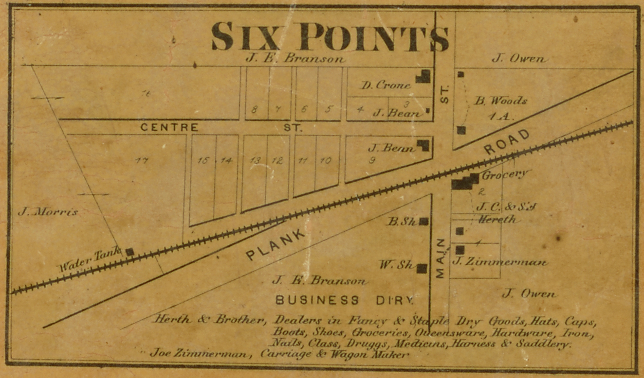
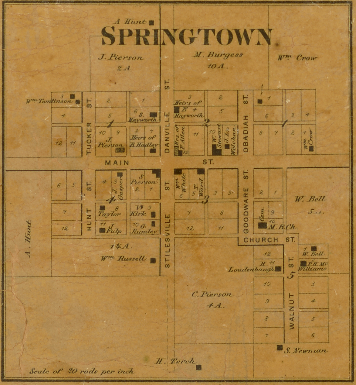
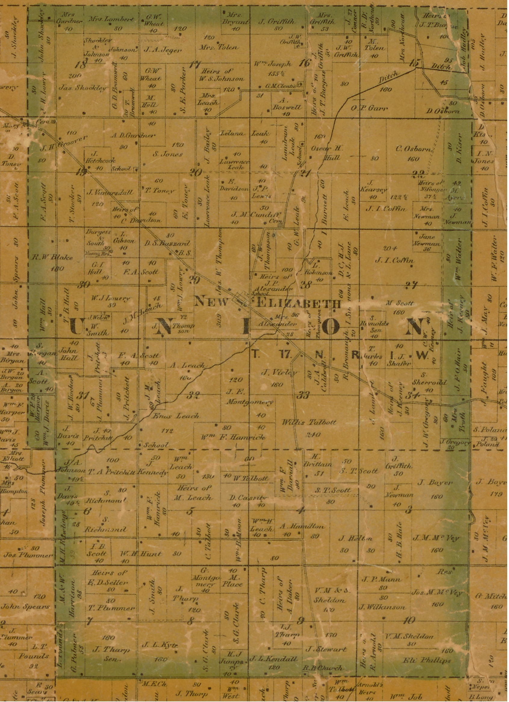
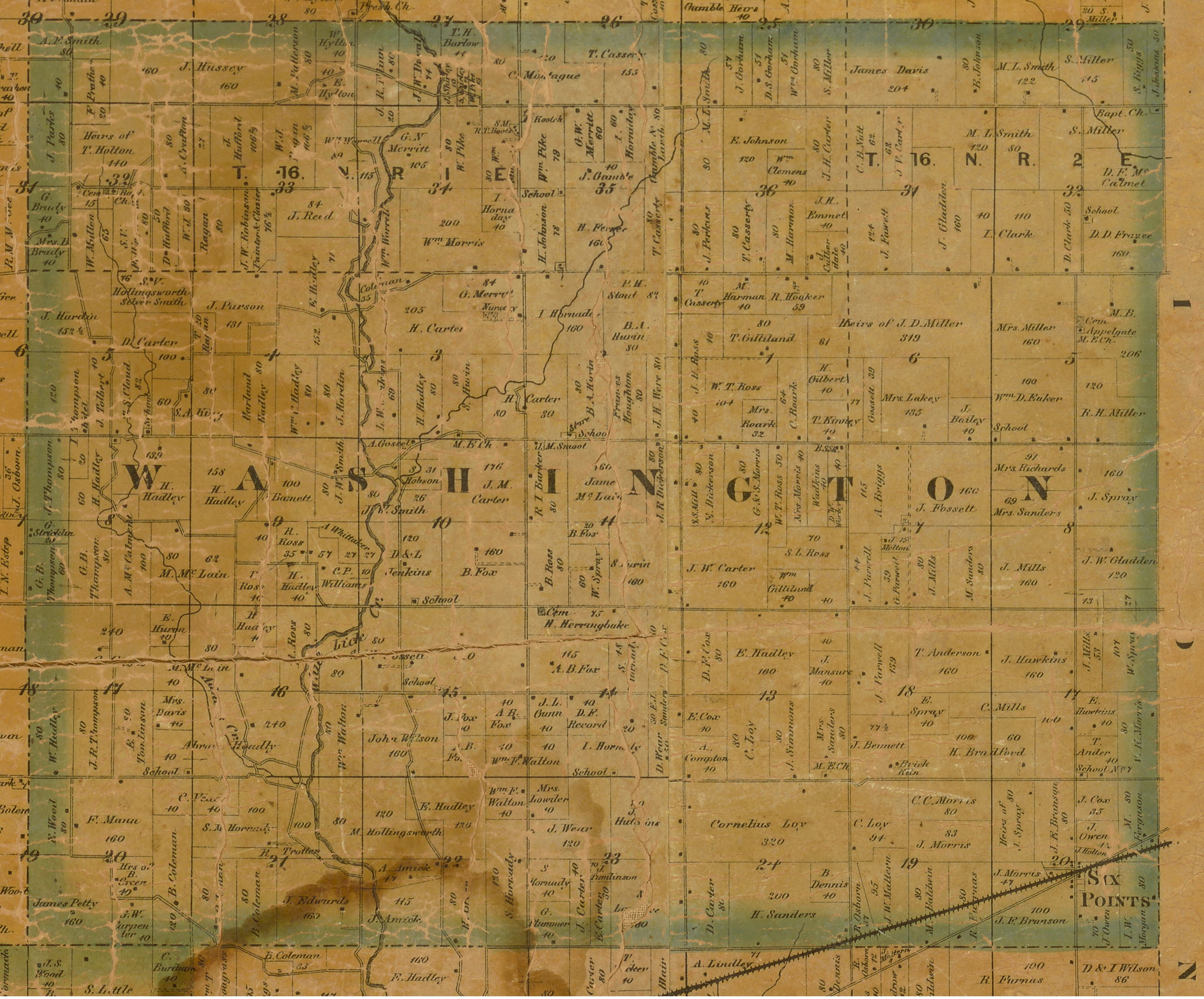
1865 Maps
page version = 3.0.02 , 10/03/2018 03:26:04 PM
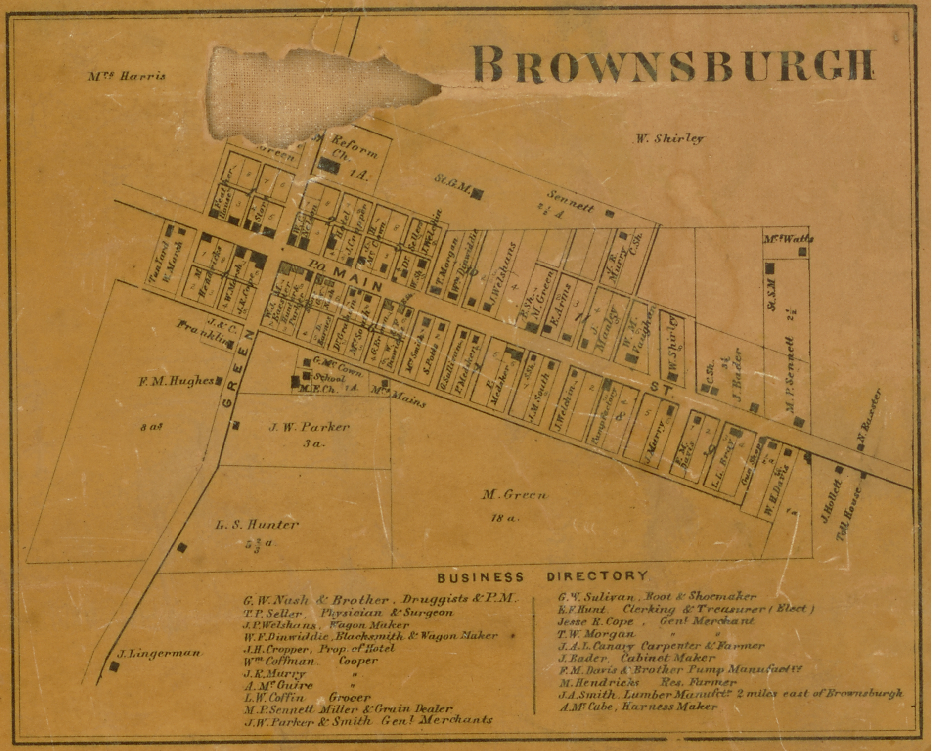
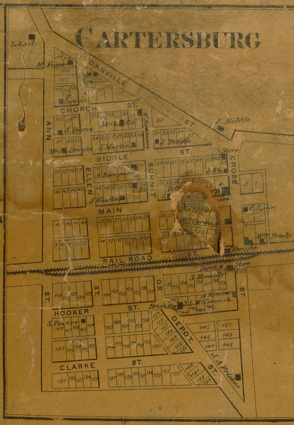
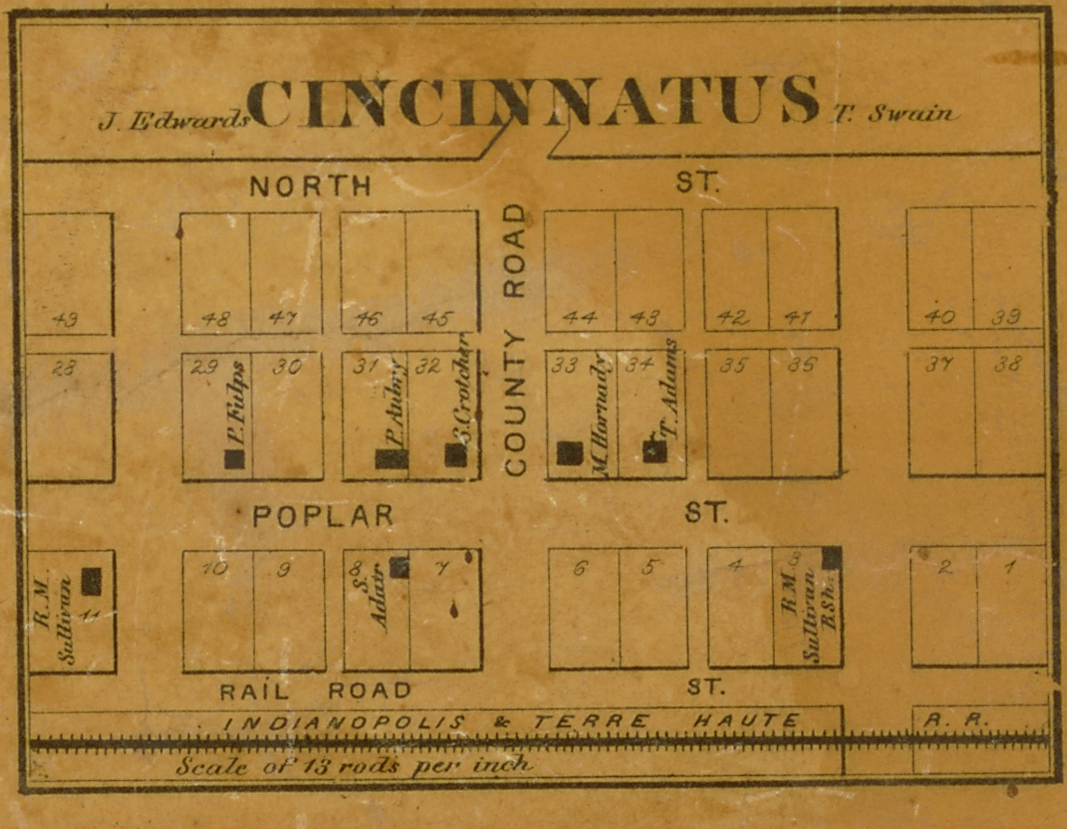
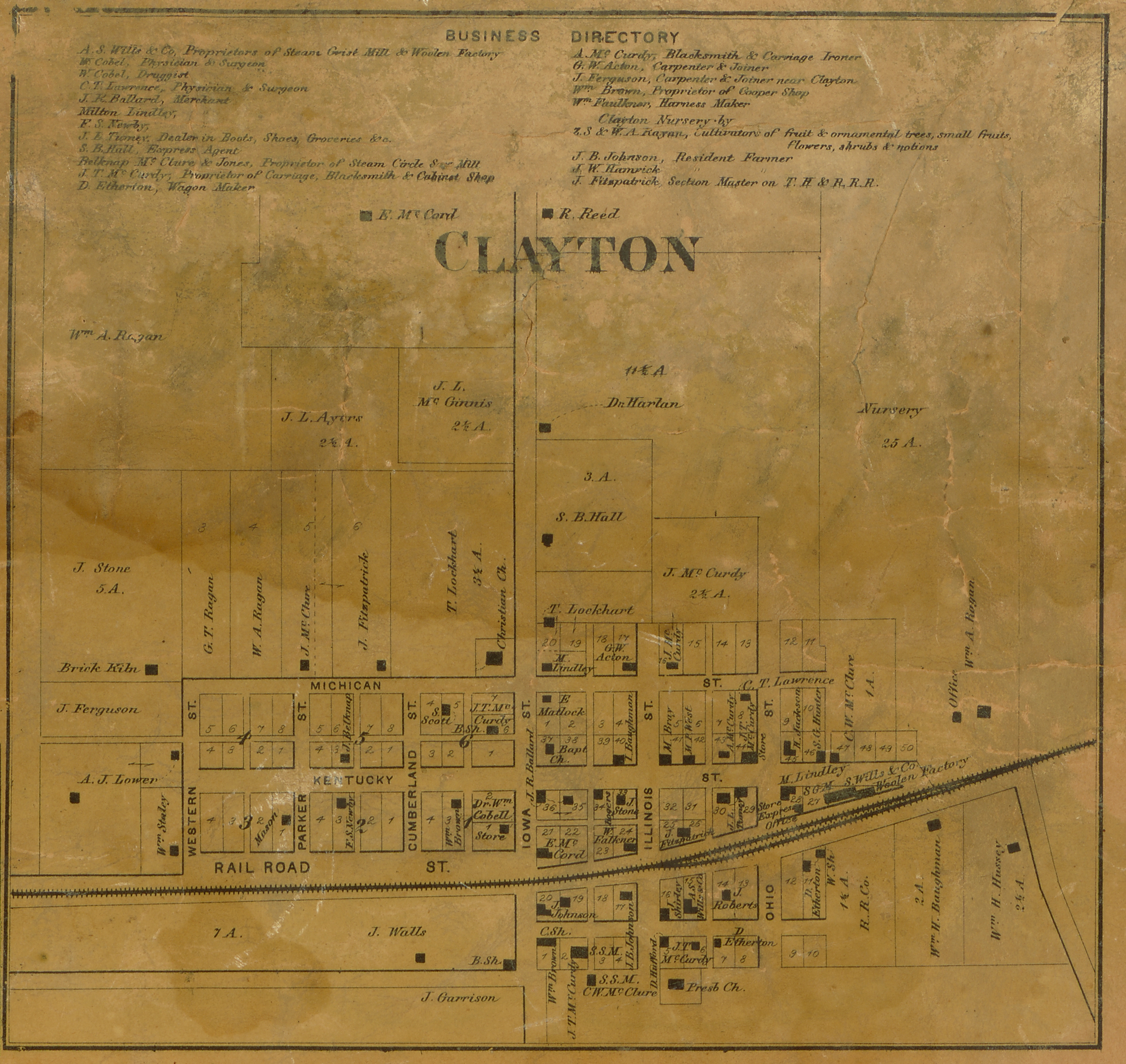
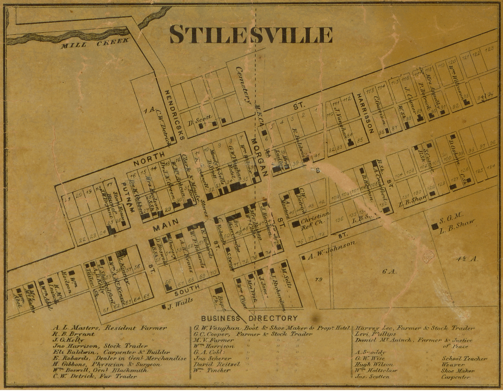
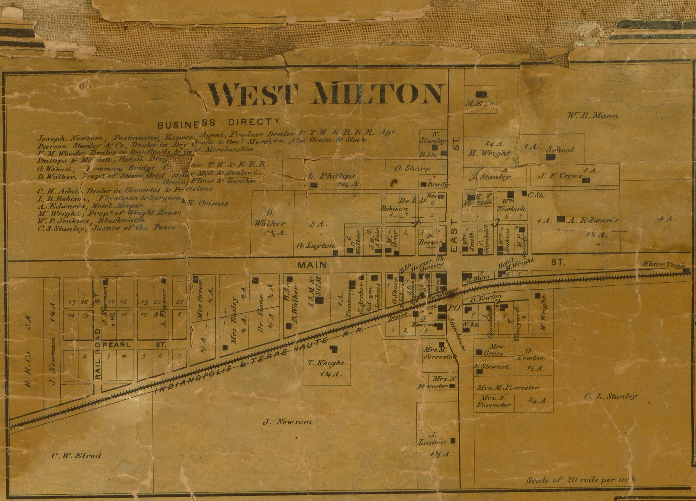
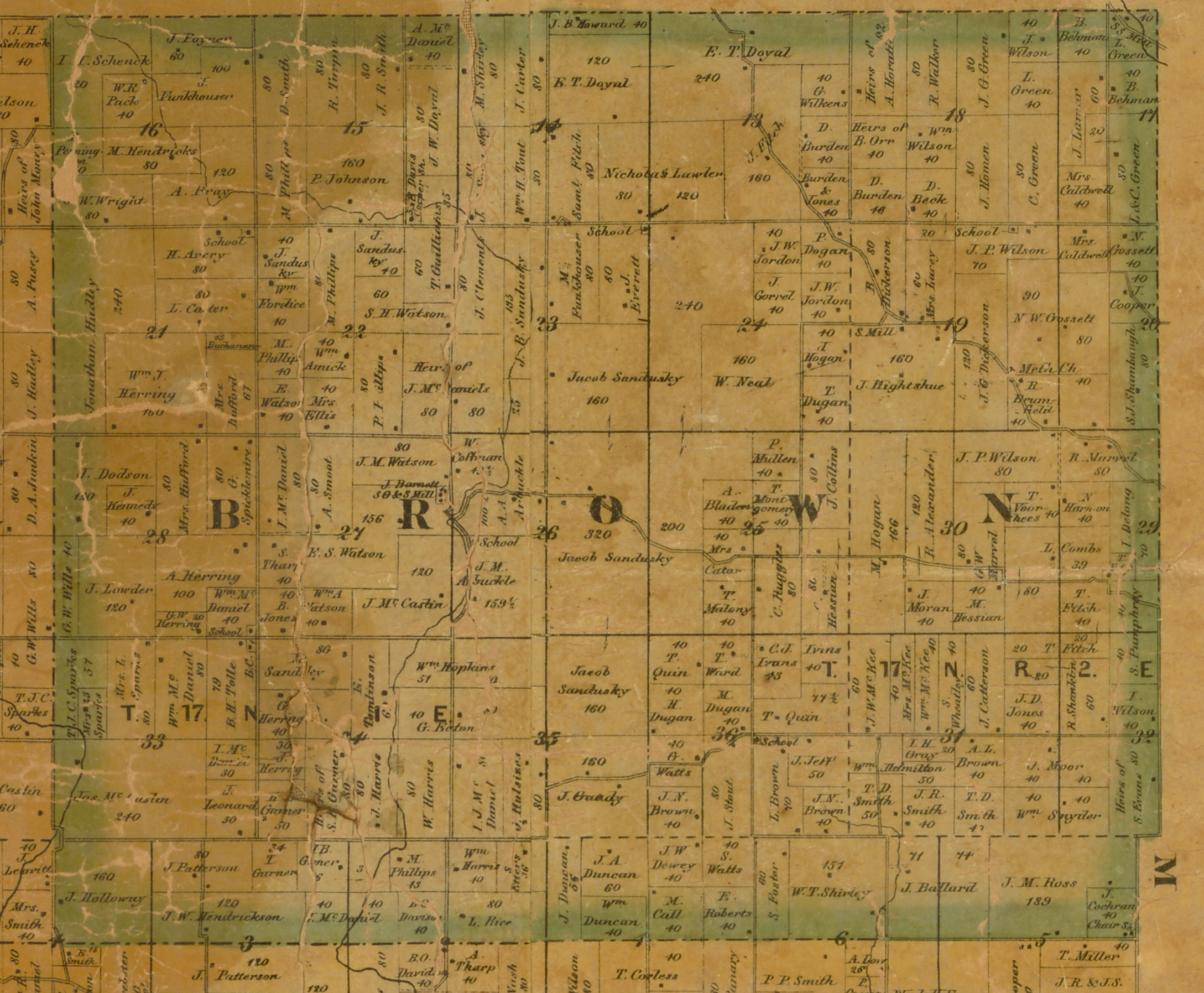
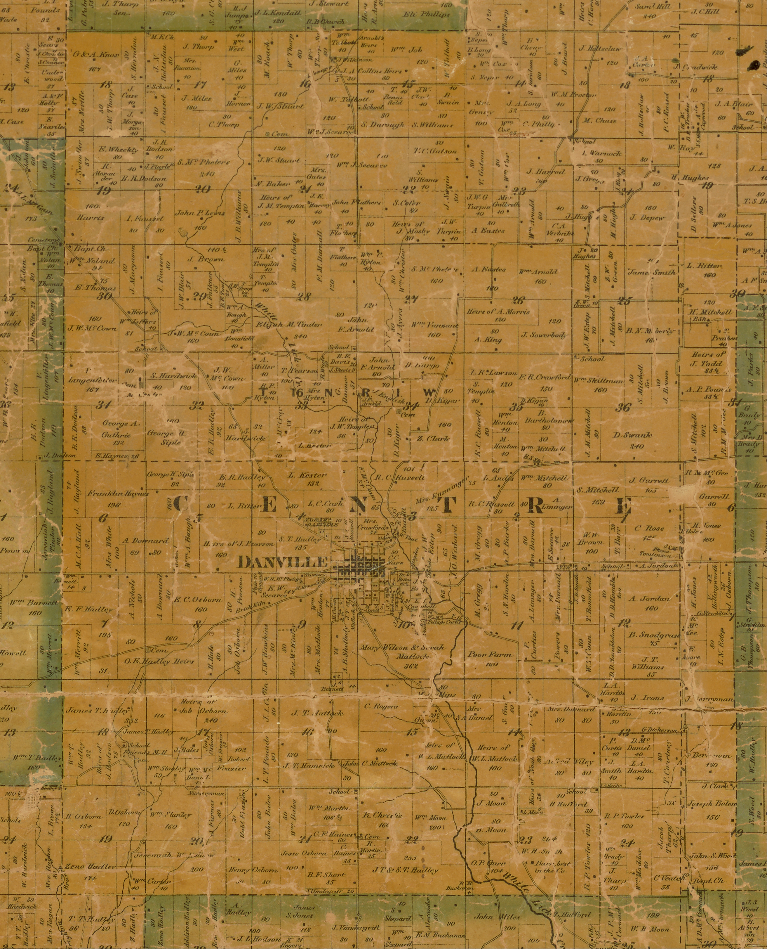
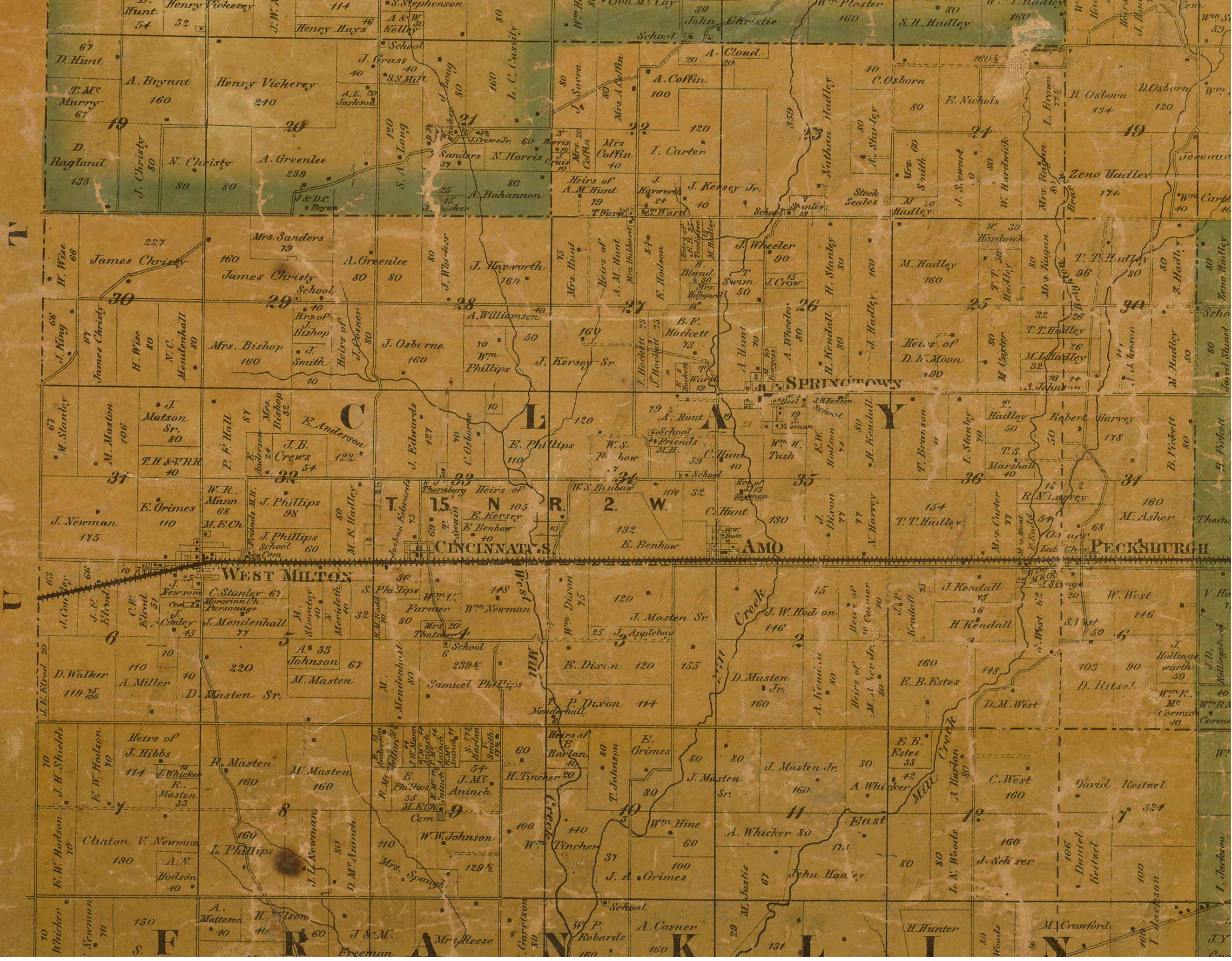
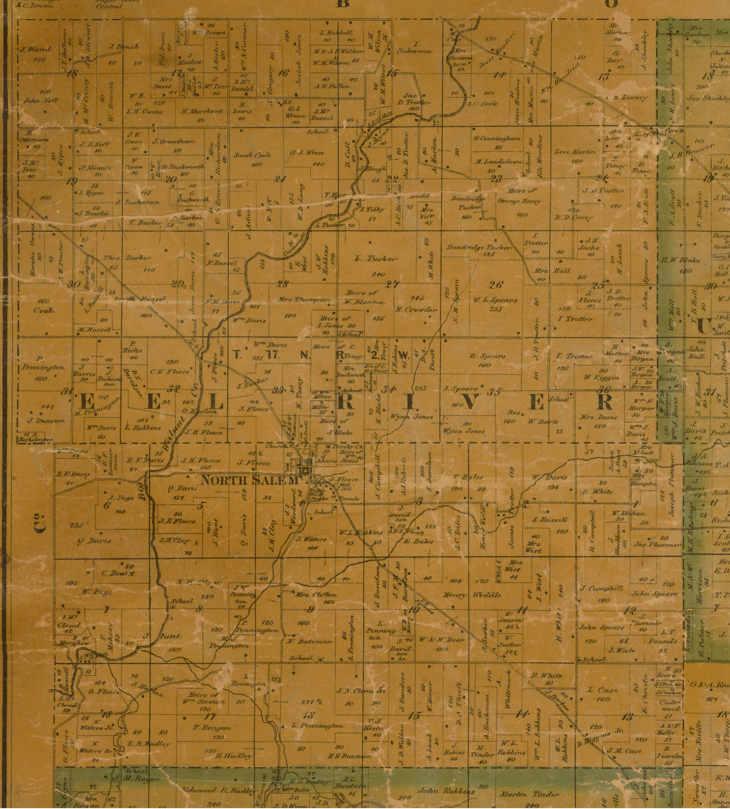
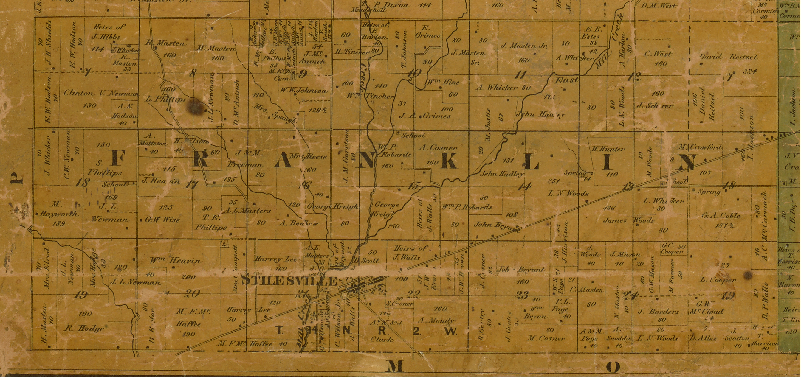
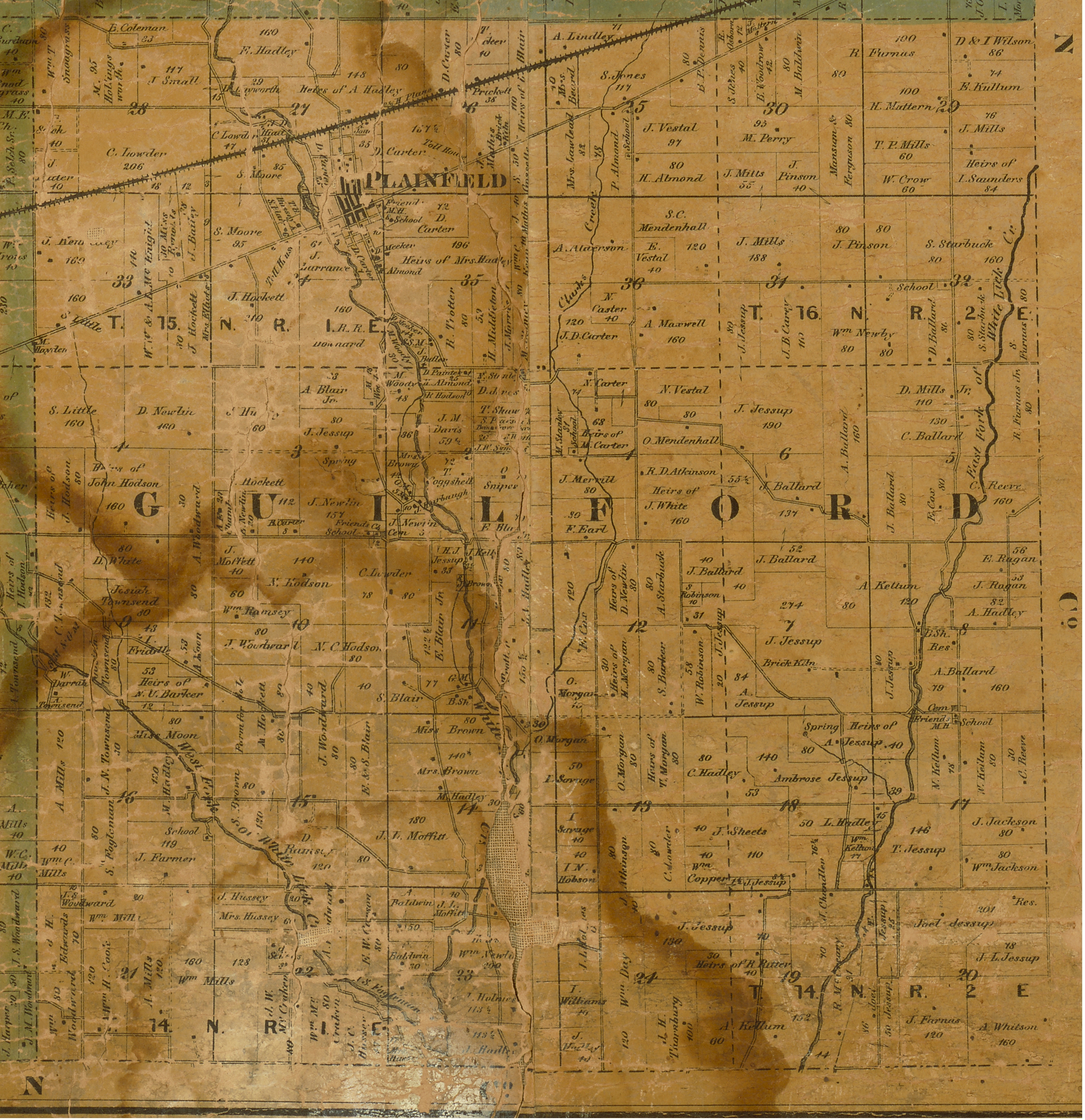
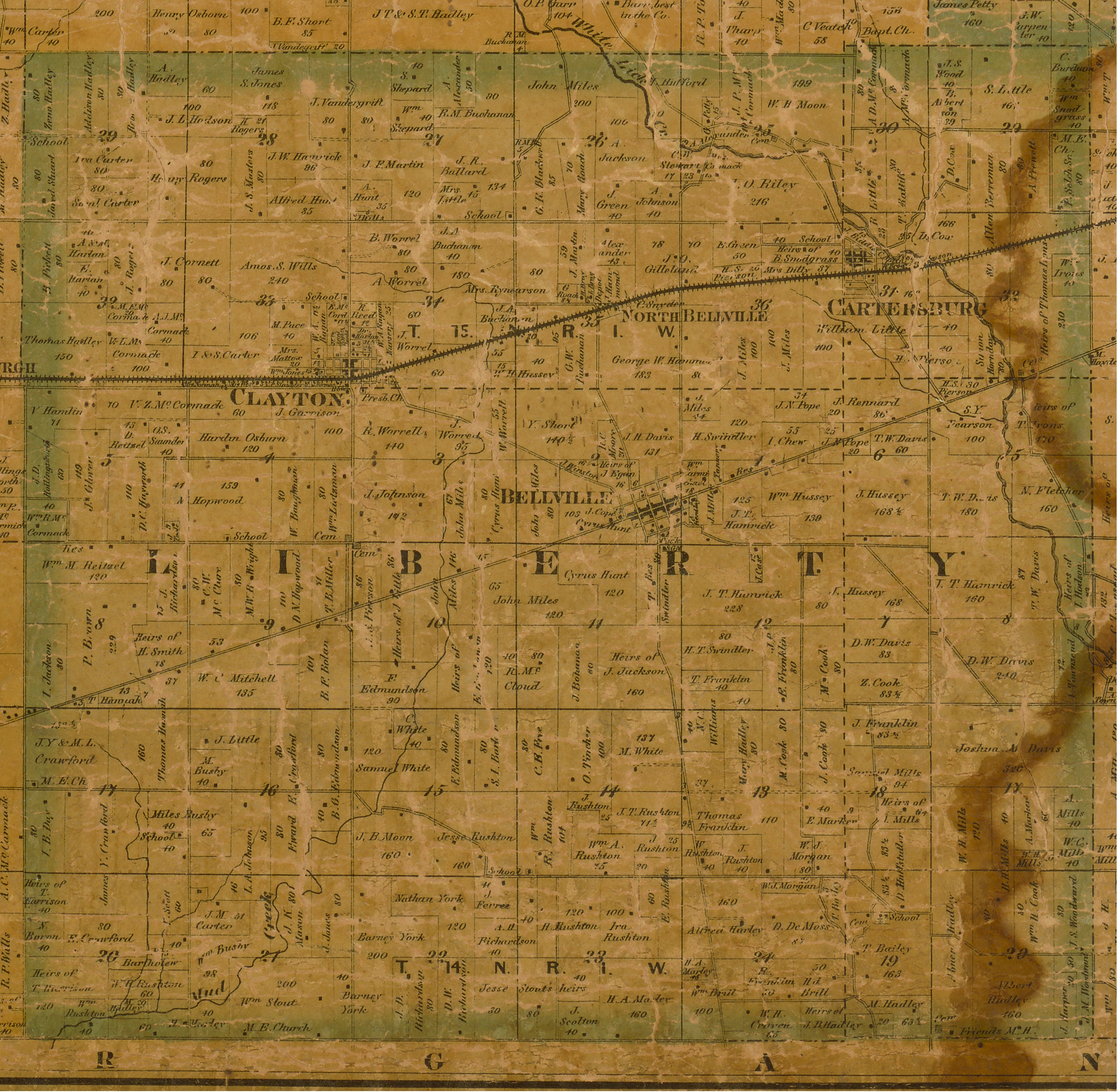
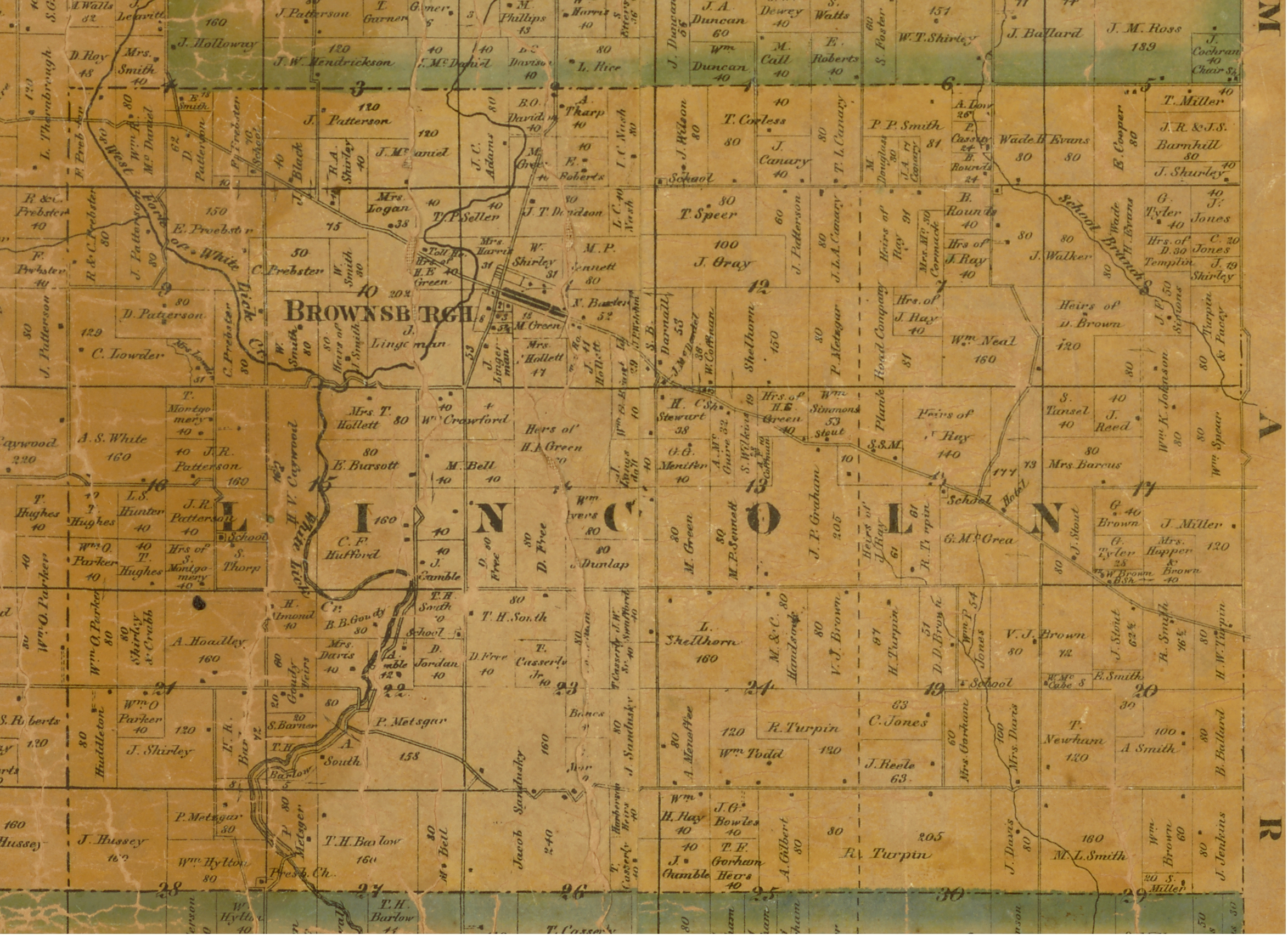
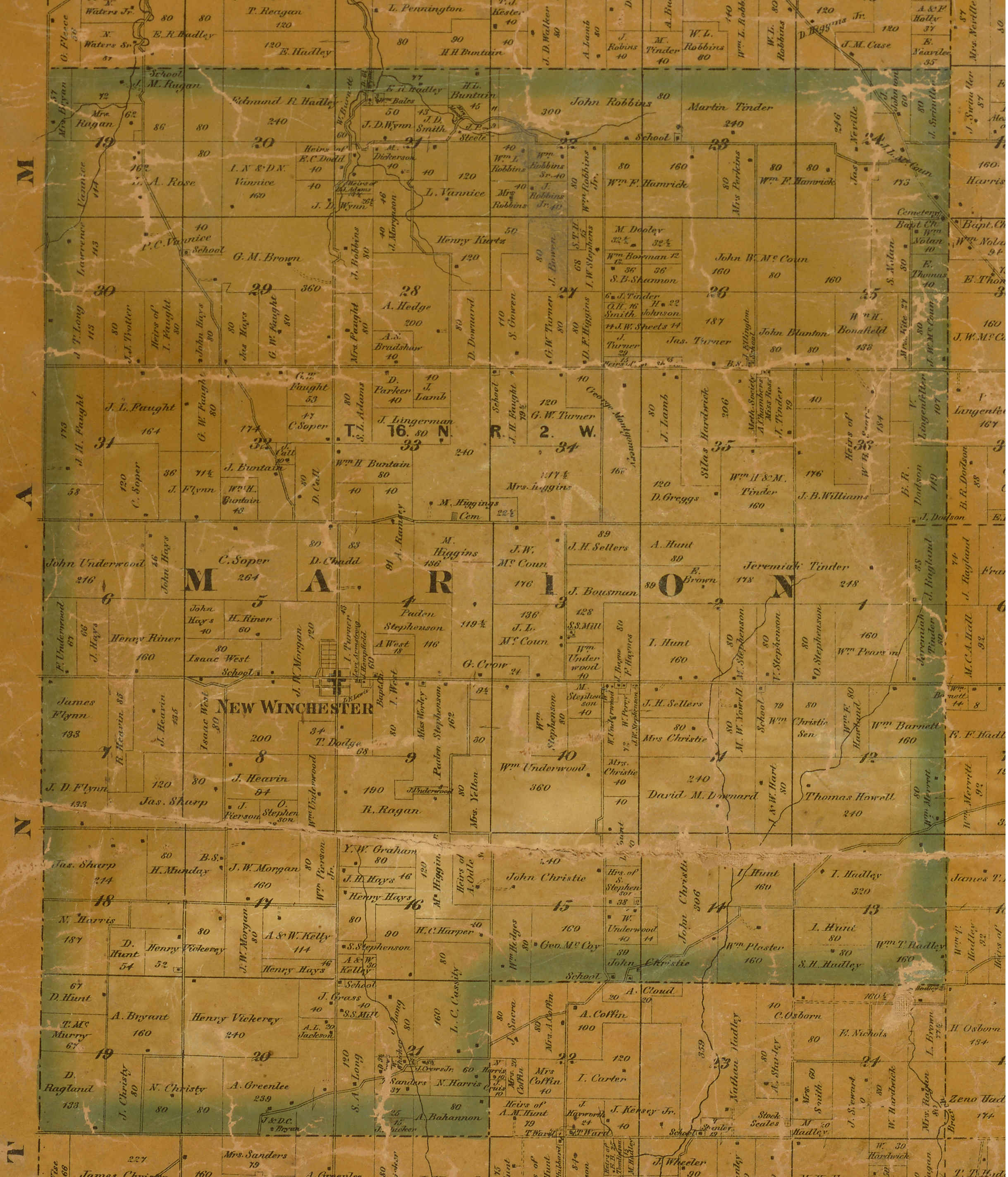
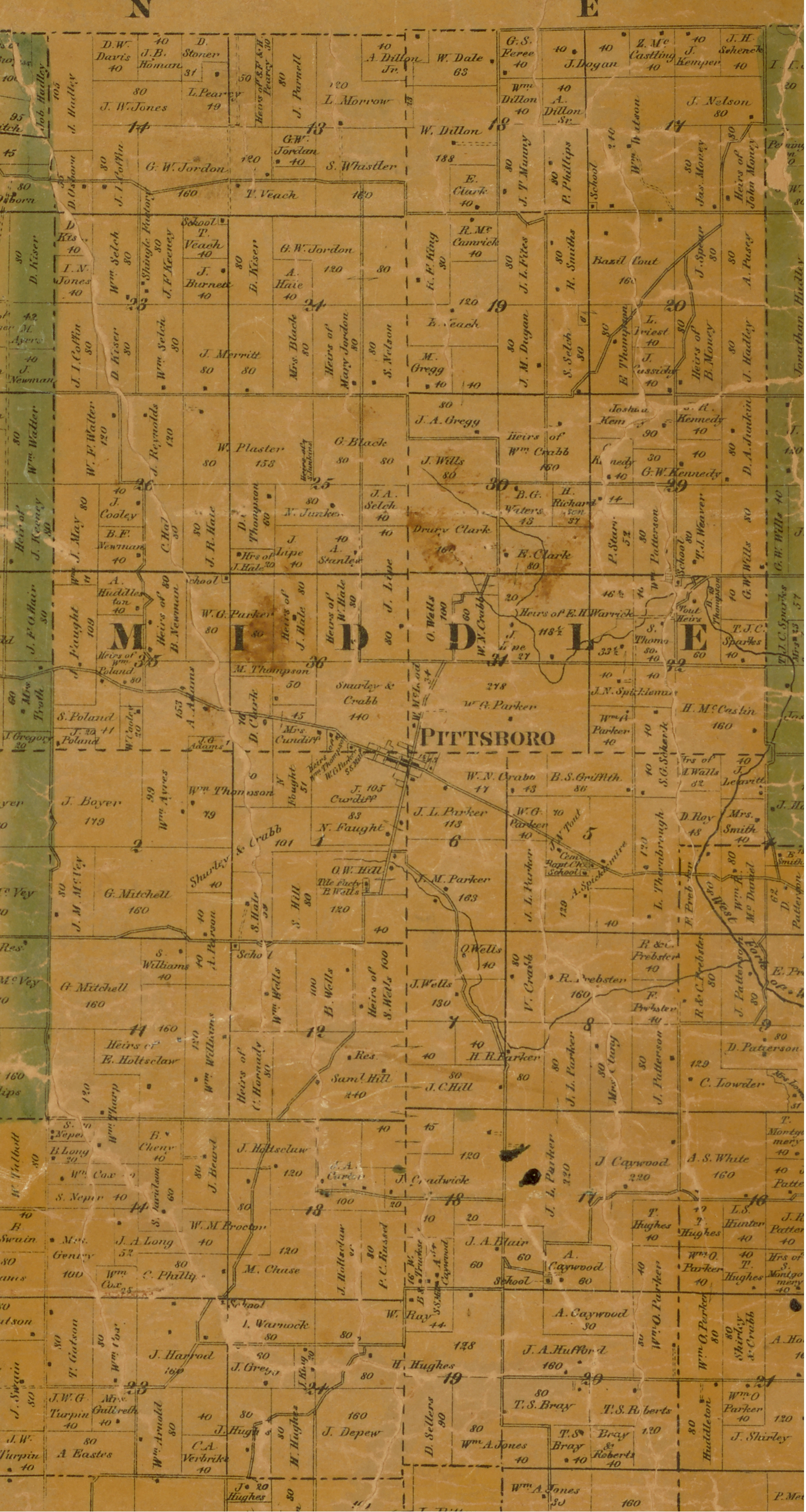
We have several historical maps of Hendricks County. As these maps are scanned, they will be presented here.
The images presented here are 1000 pixels wide. When you open these images, your browser may show the image at a decreased size.
Typically you can hover over the image and your browser will allow you to expand the image.
If your computer screen is able to display 1000 pixels wide, you should see the image at the original size.
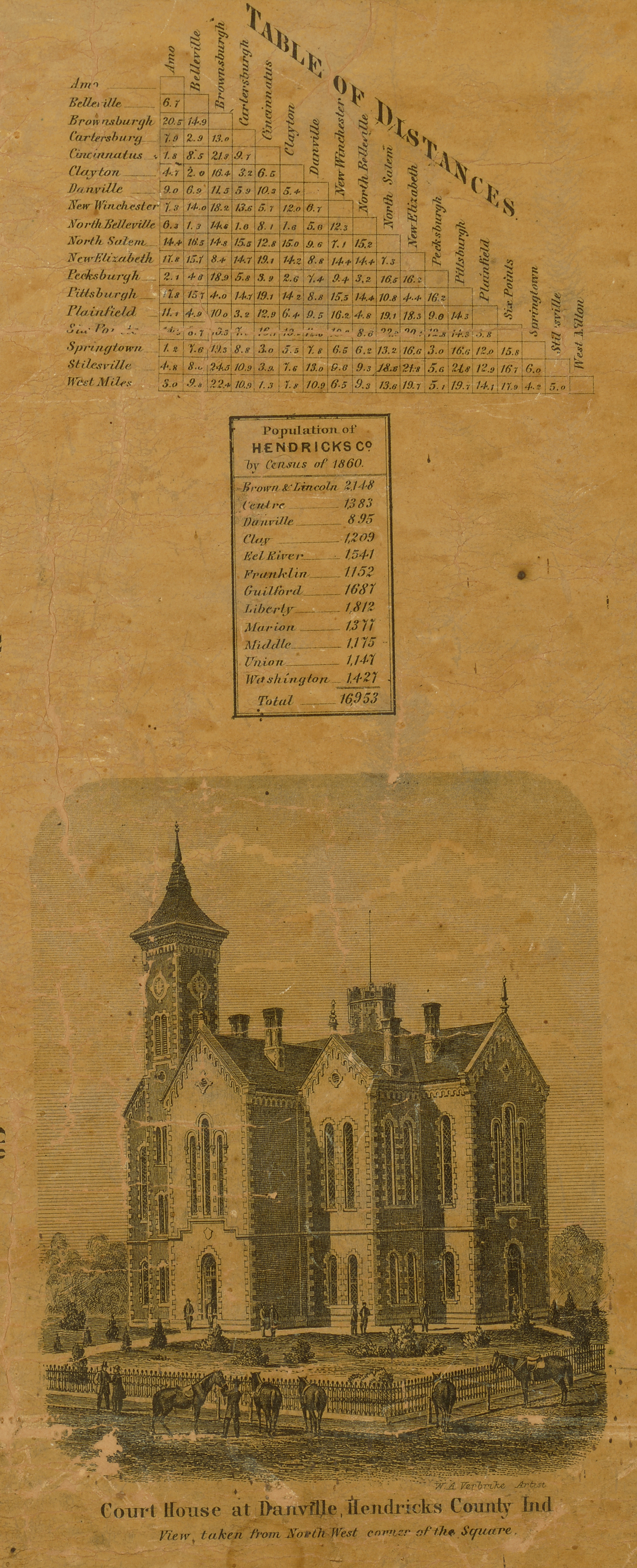
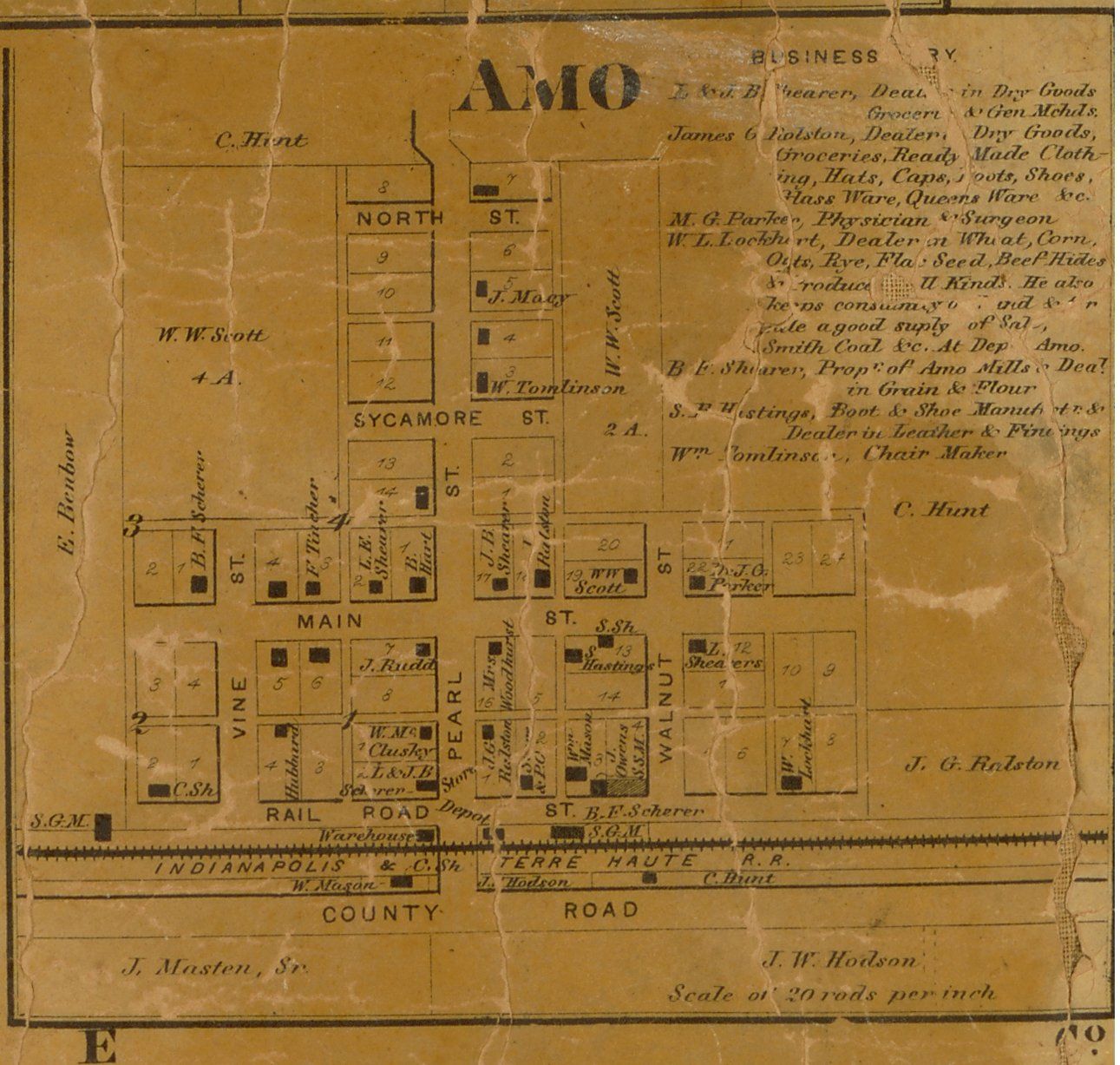
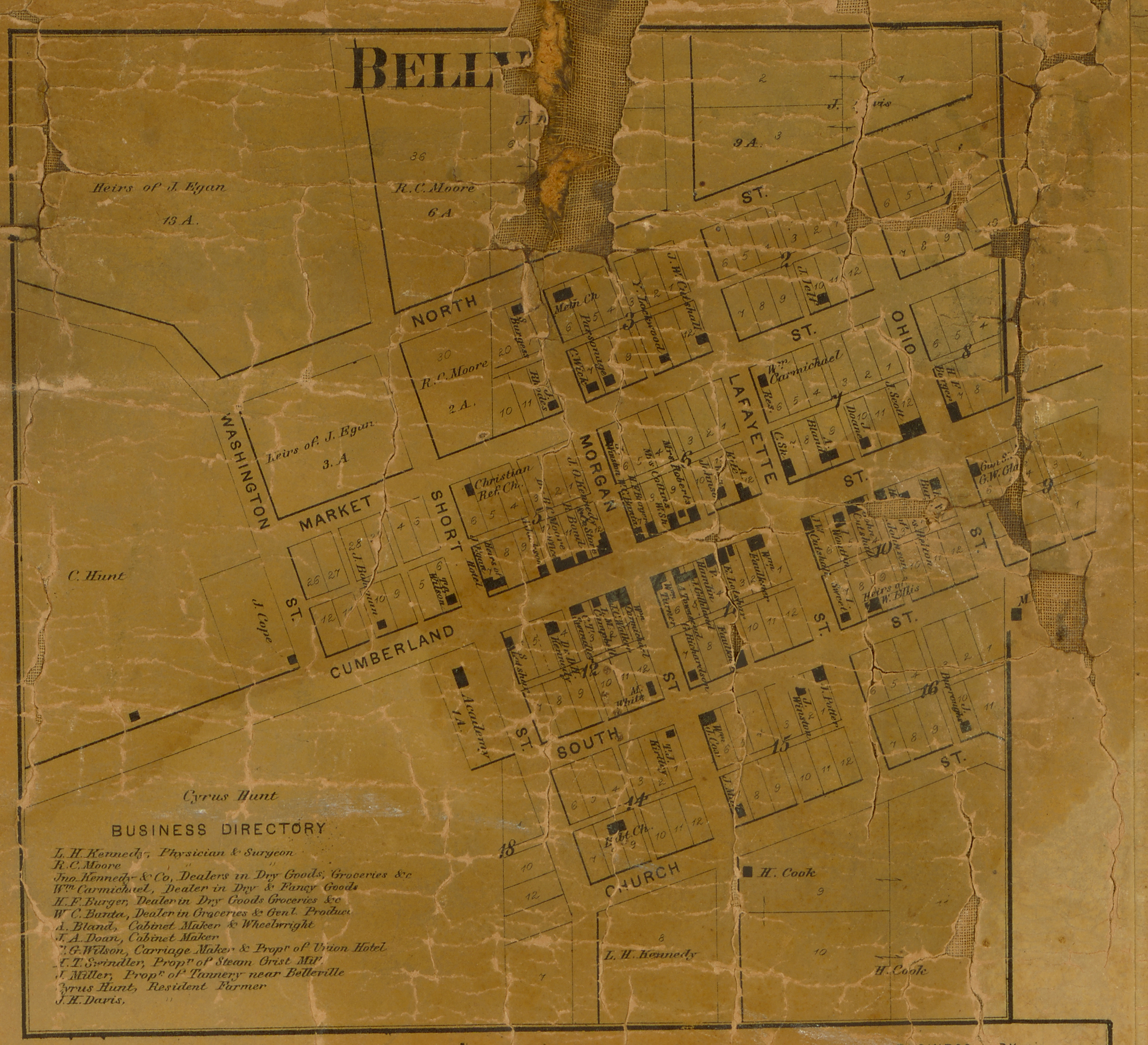
Some maps are very large, so we scanned individual towns into separate images. For the 1865 map we also show the full county map.
