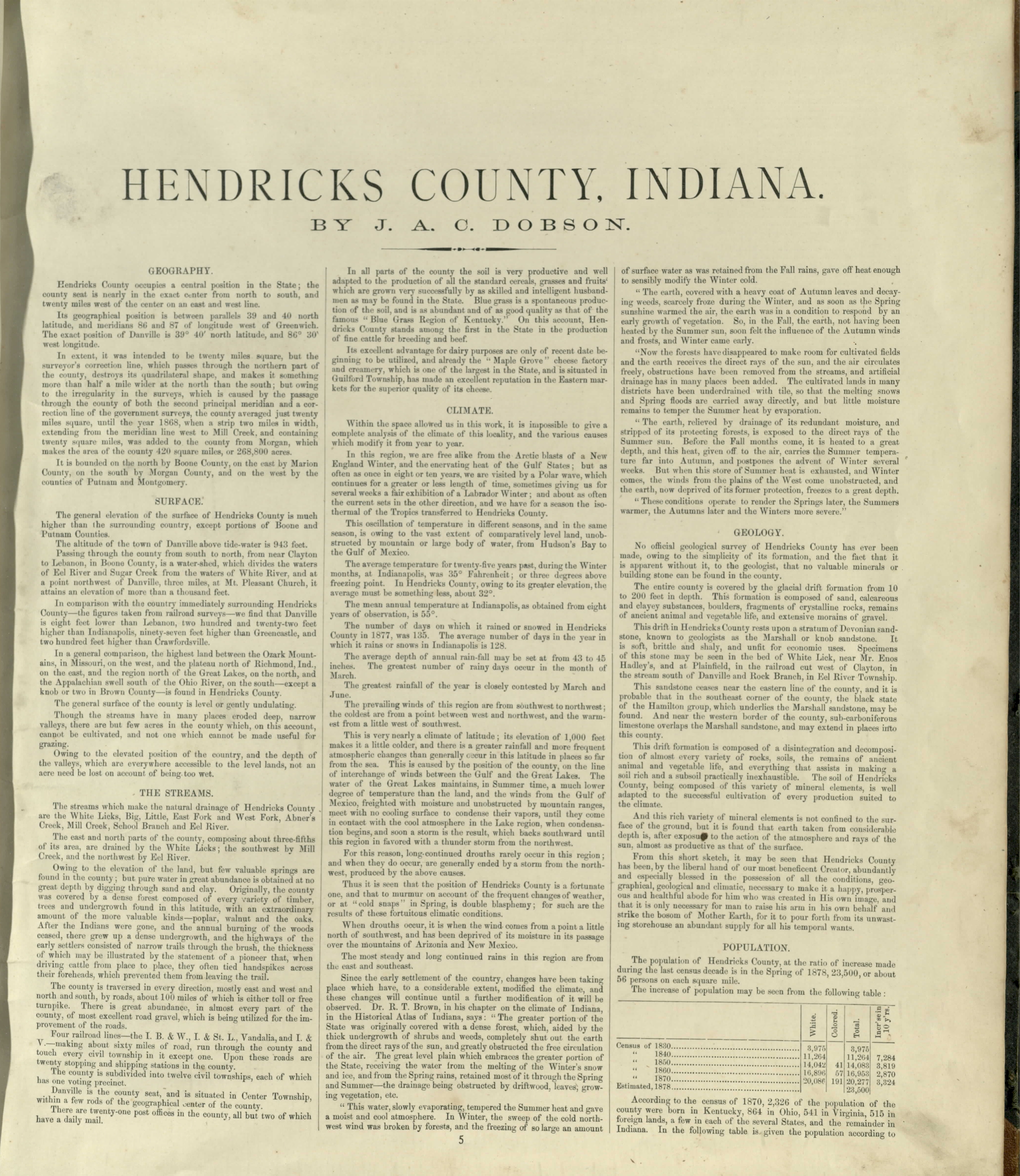
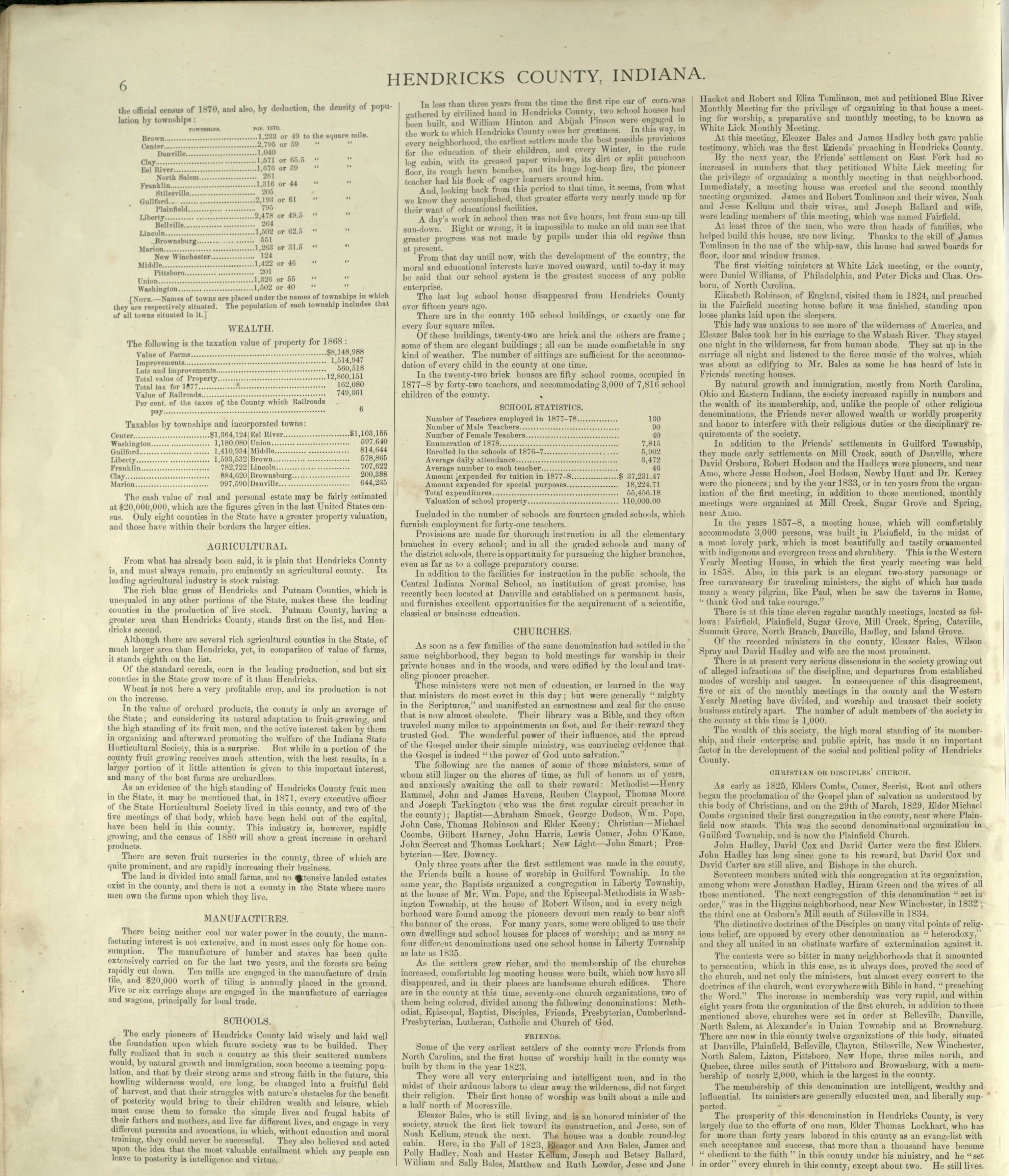
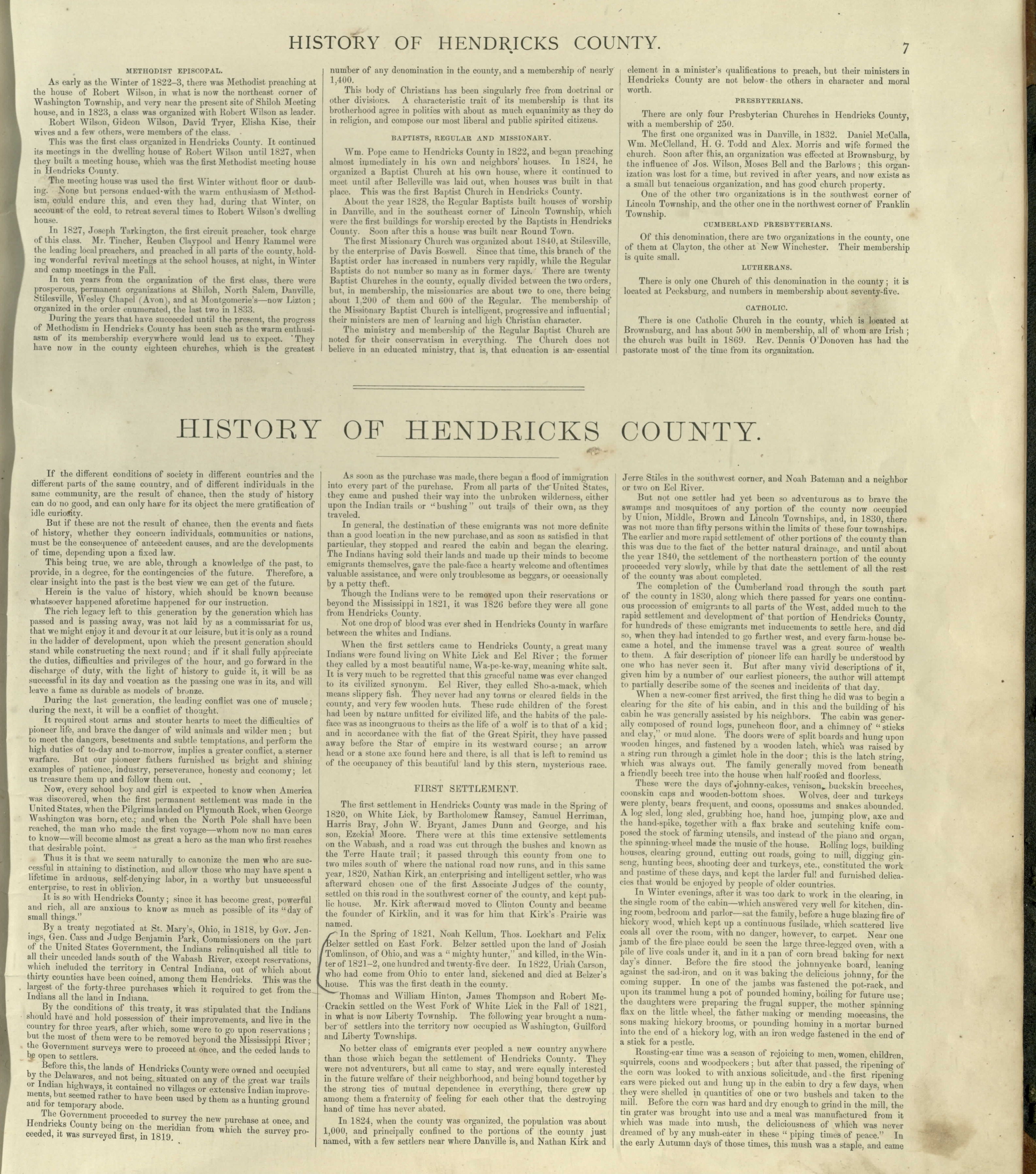
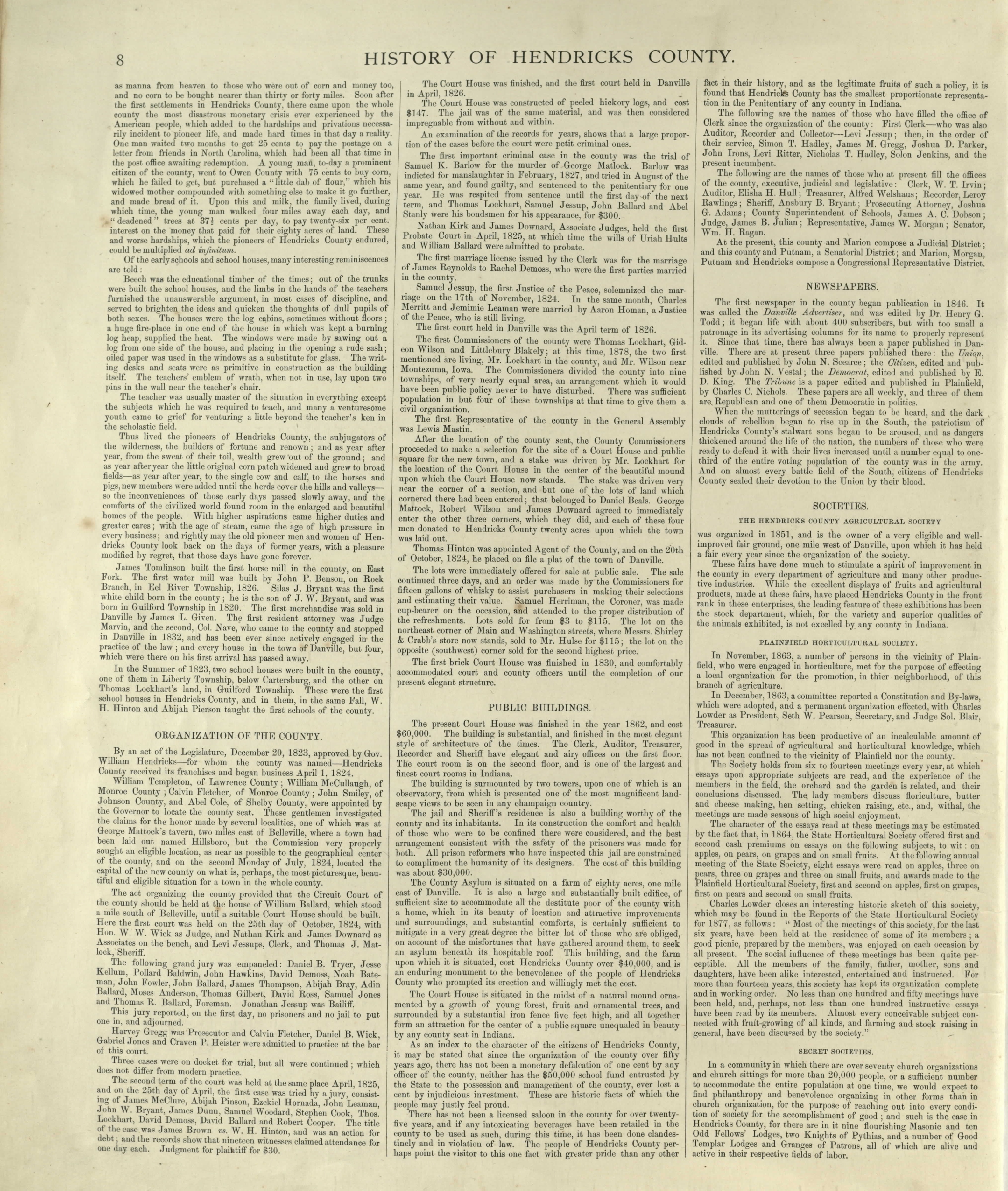
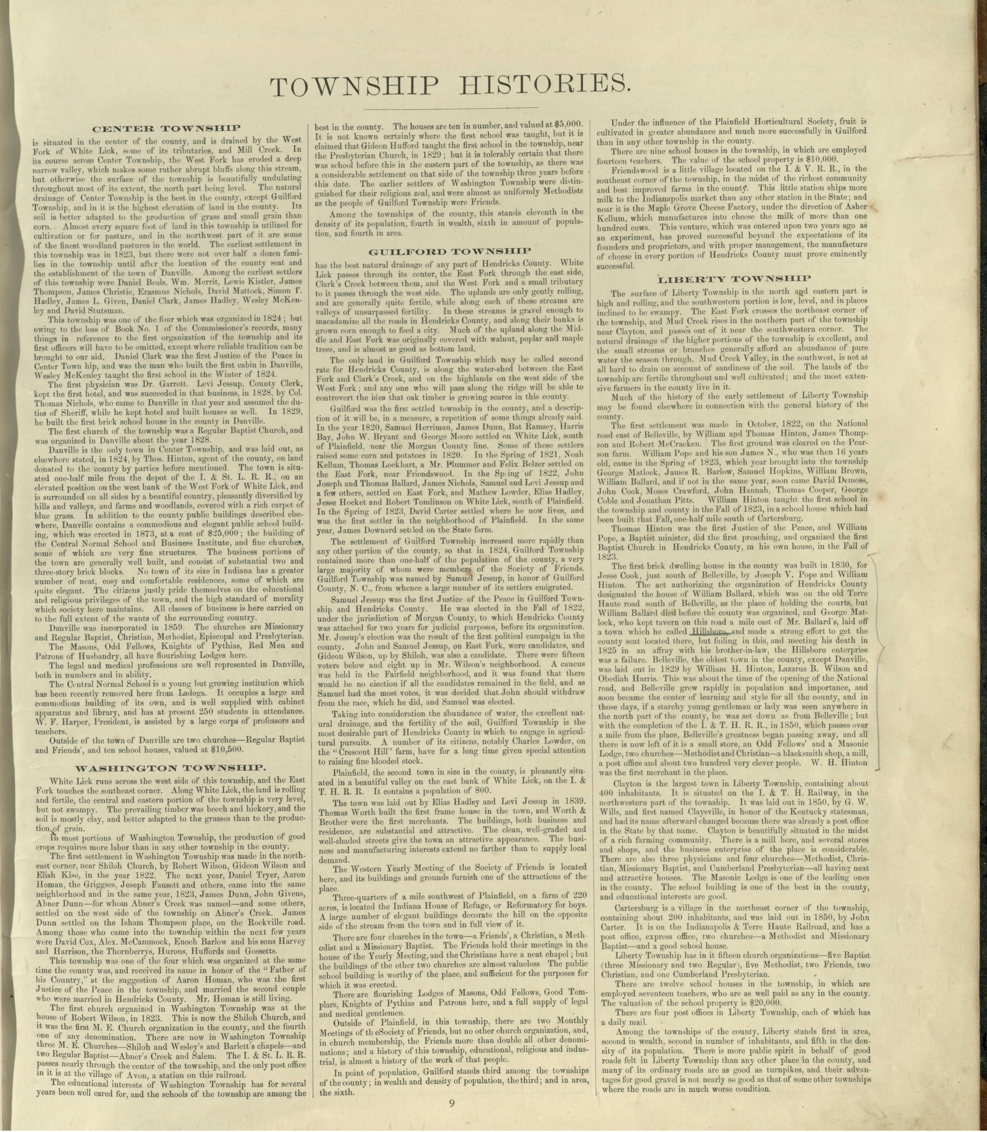
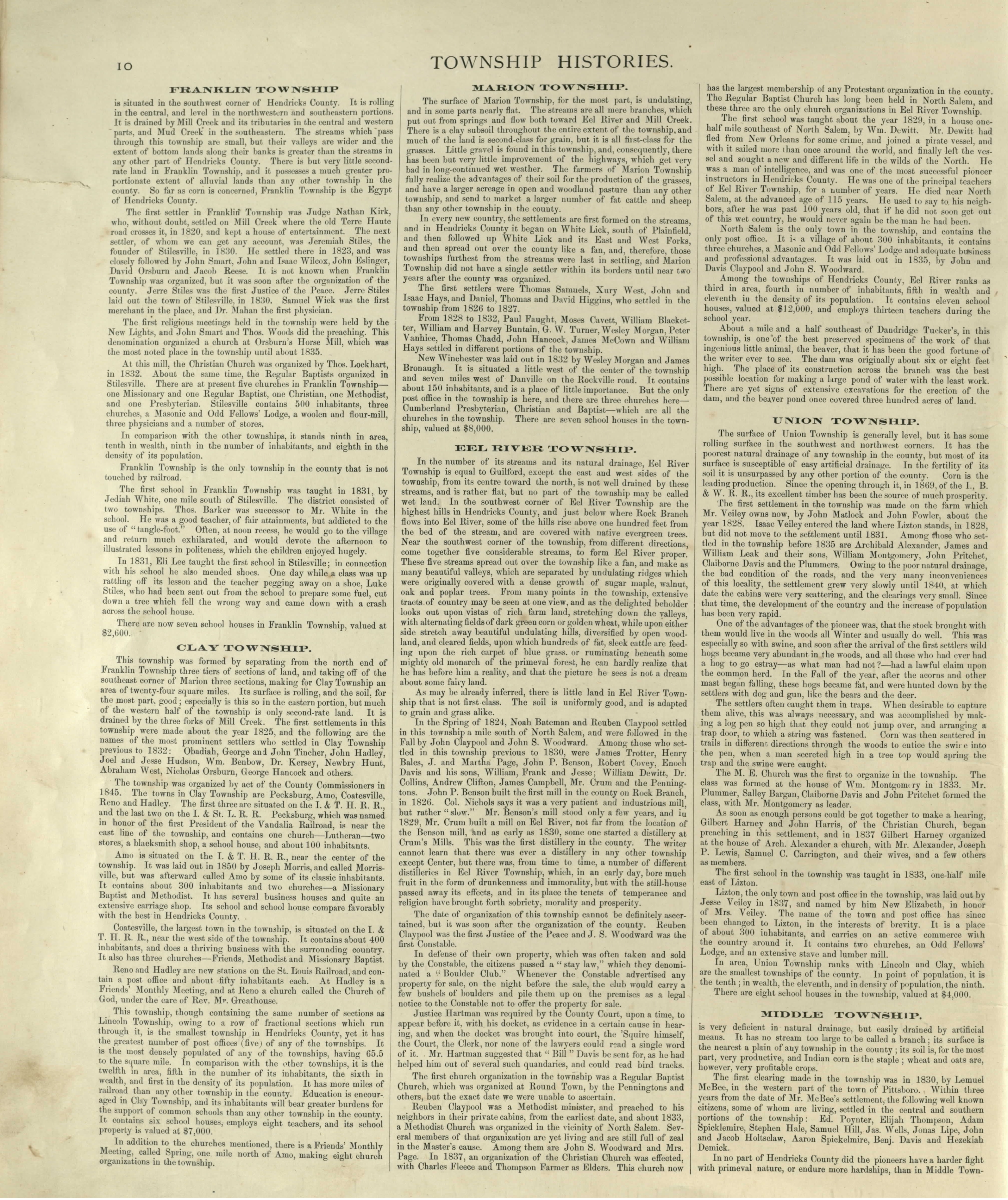
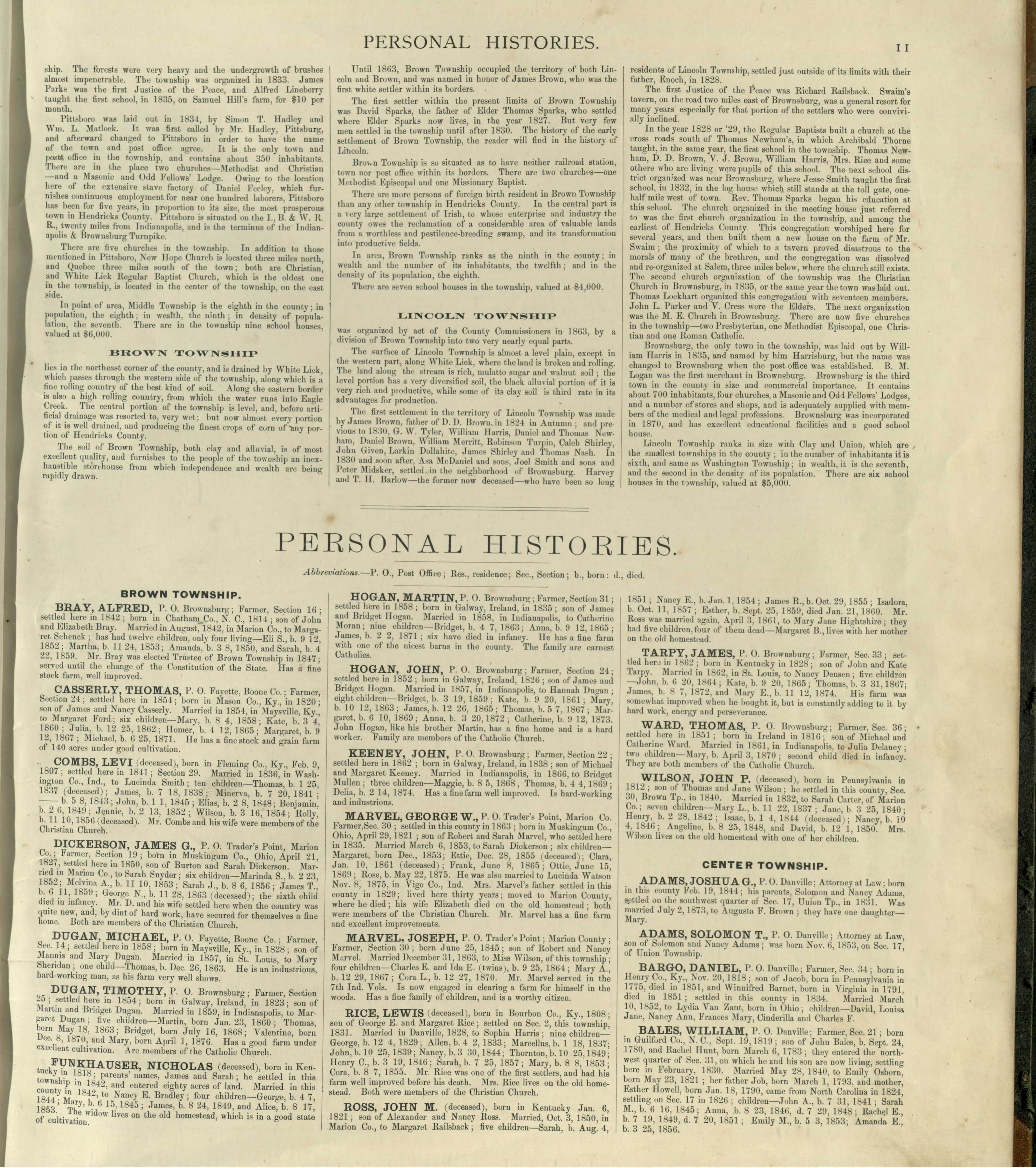
1878 Maps
page version = 3.0.02 , 10/03/2018 03:25:40 PM
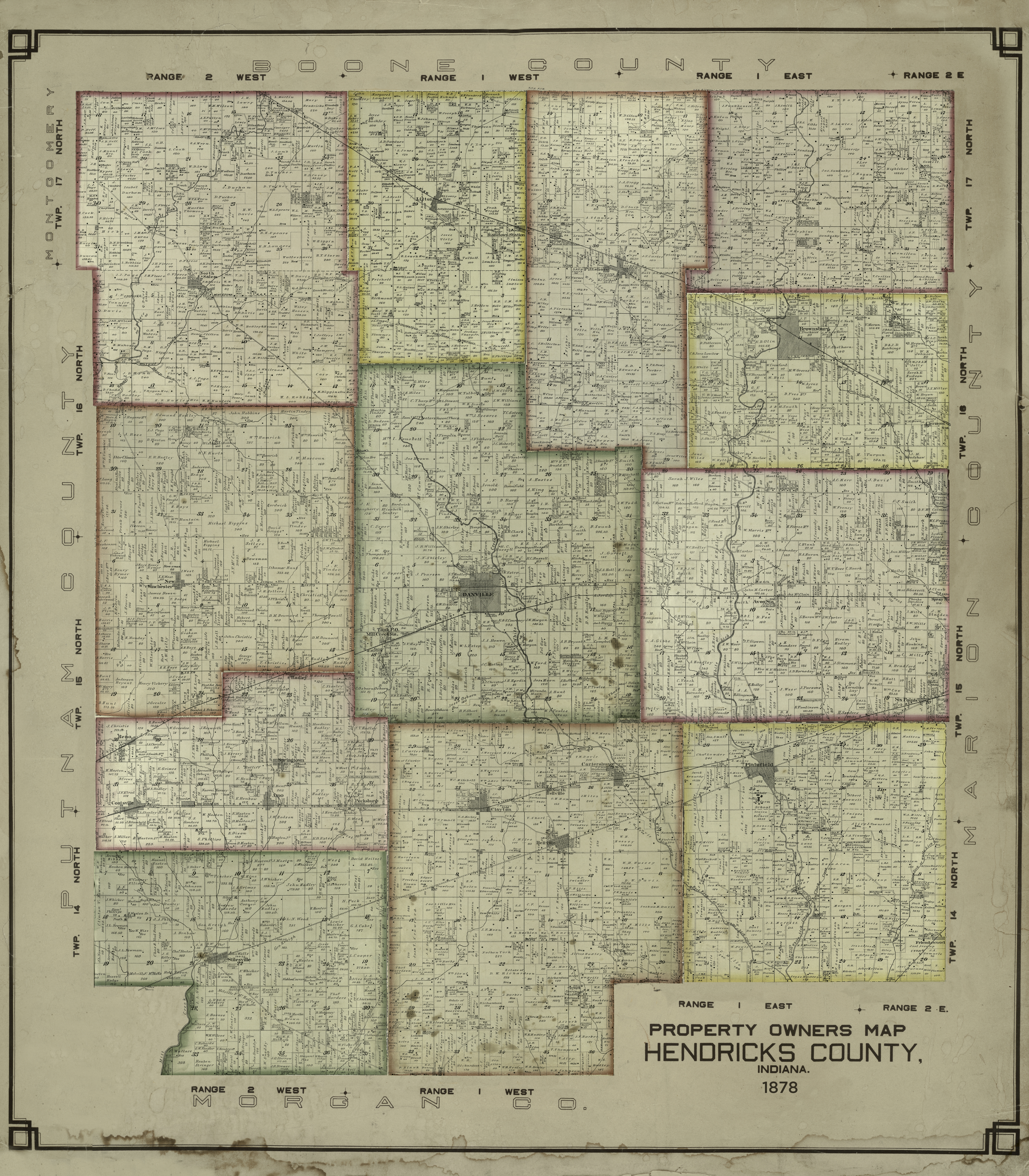
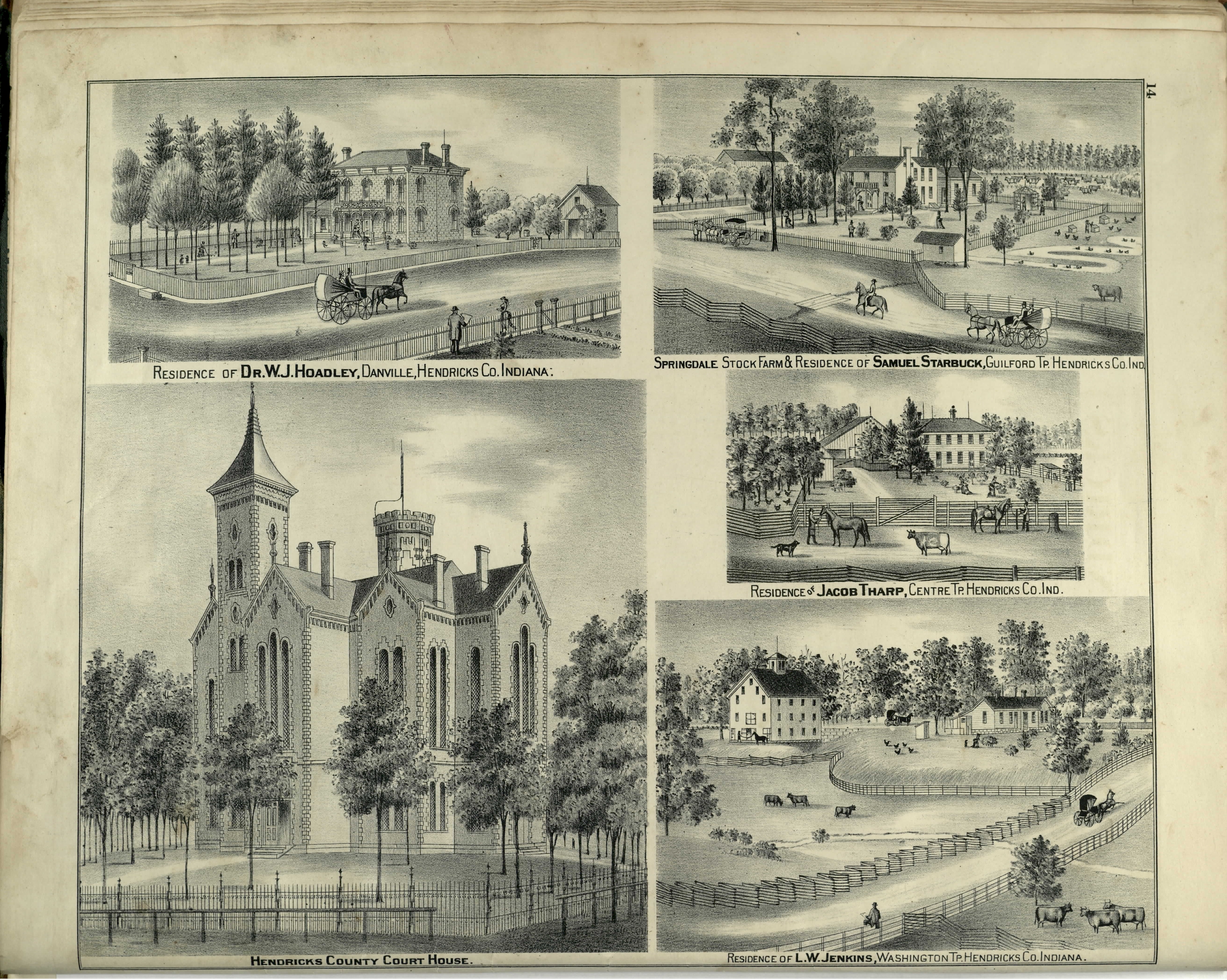
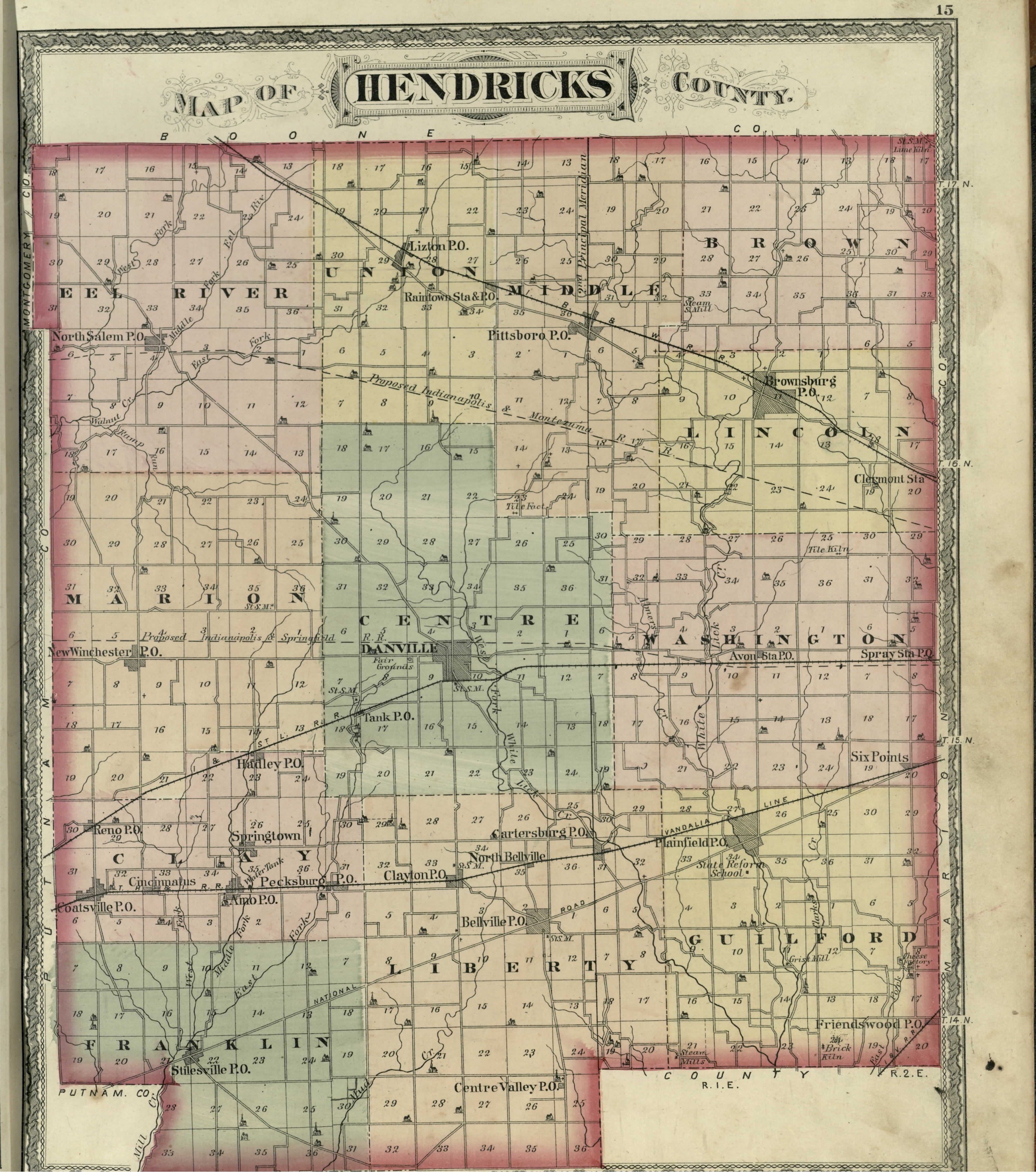
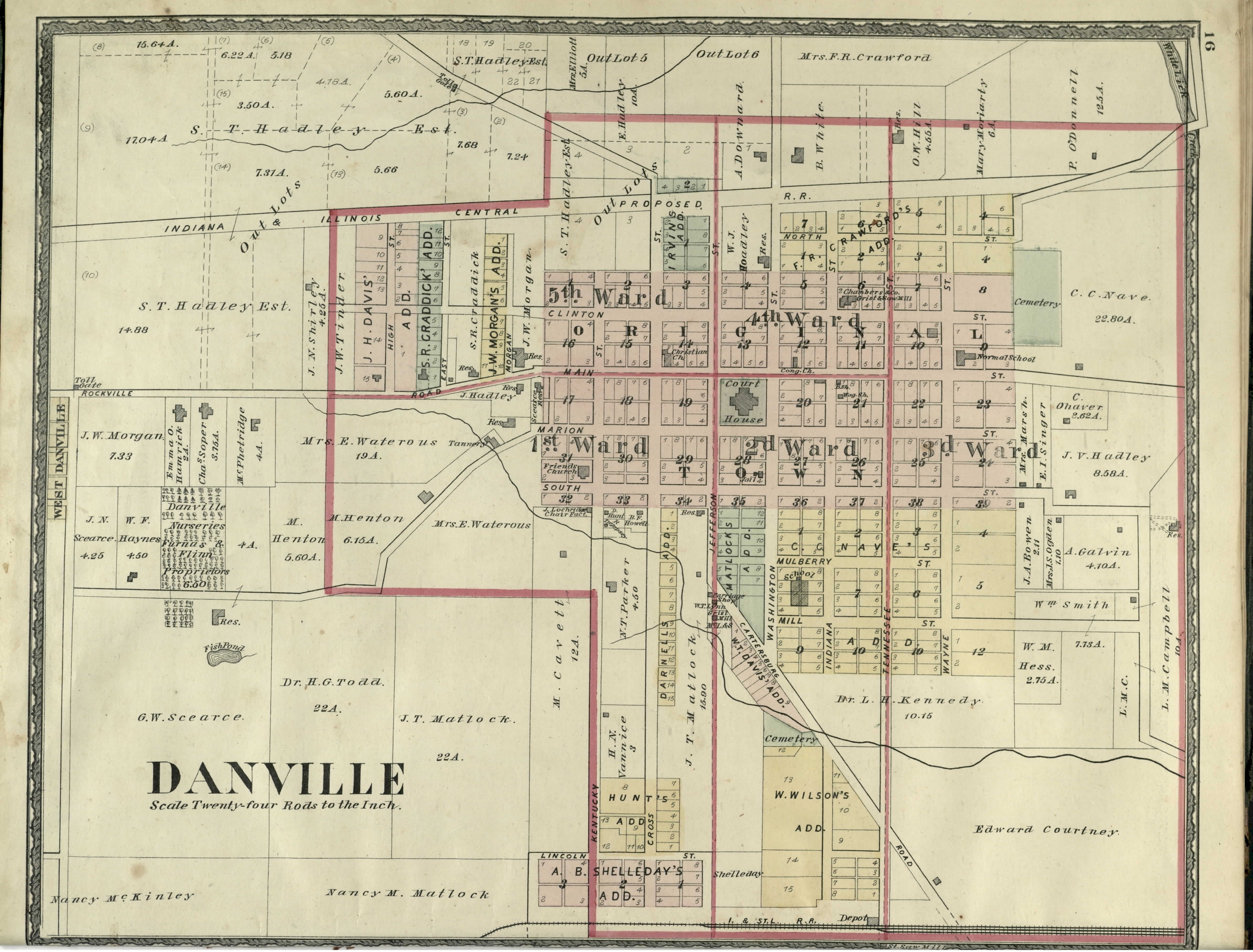
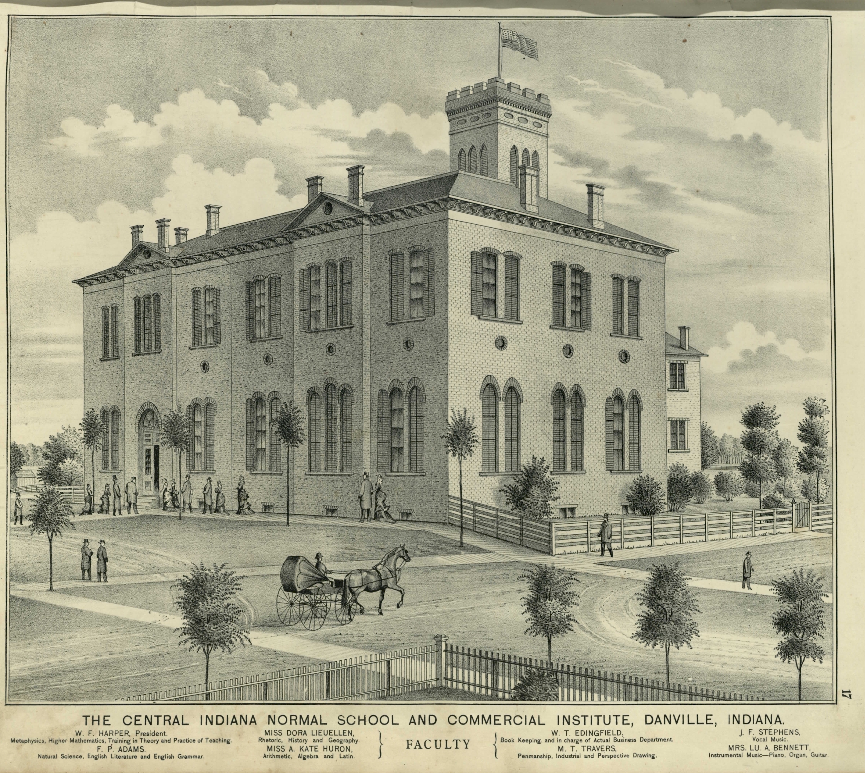
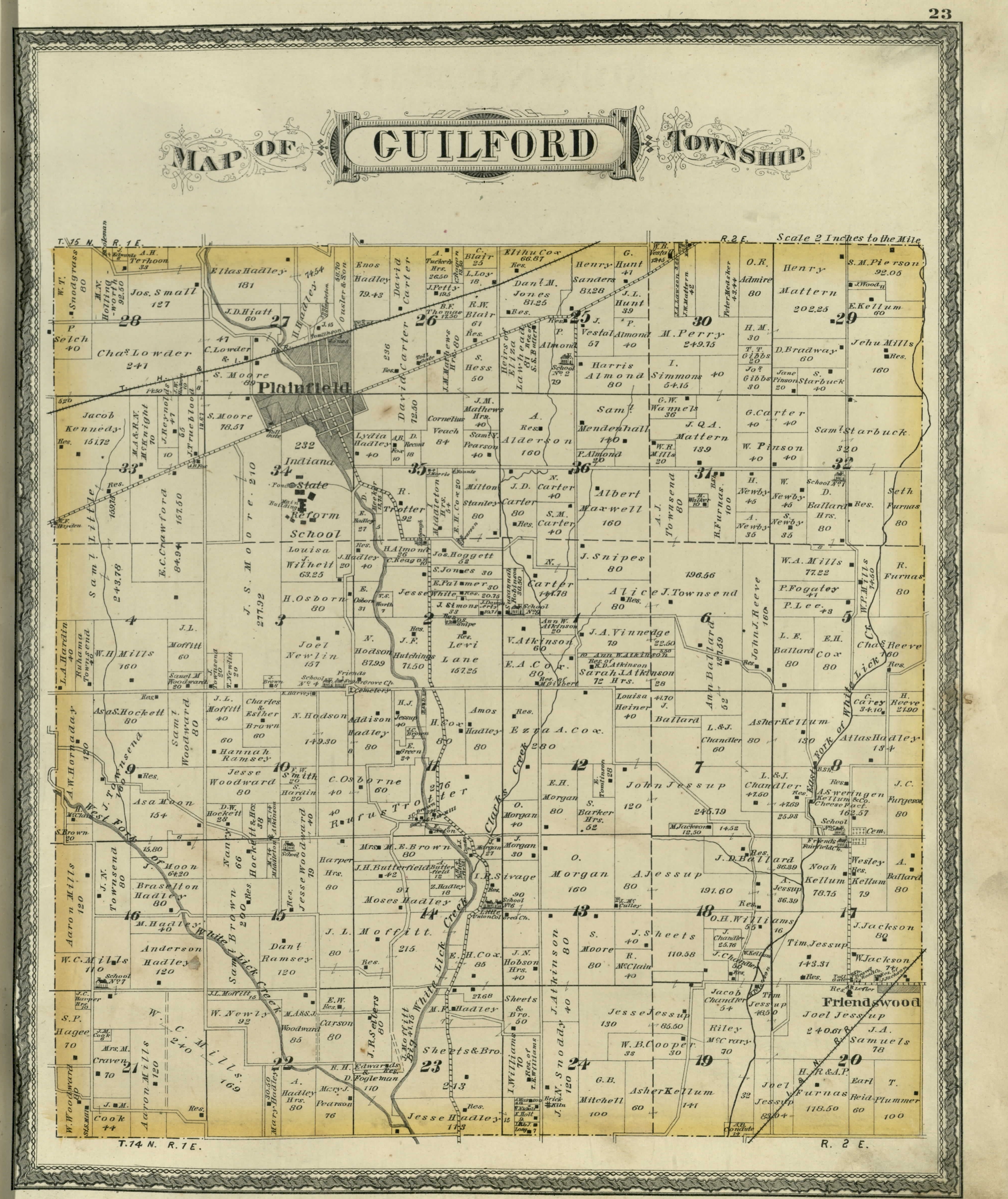
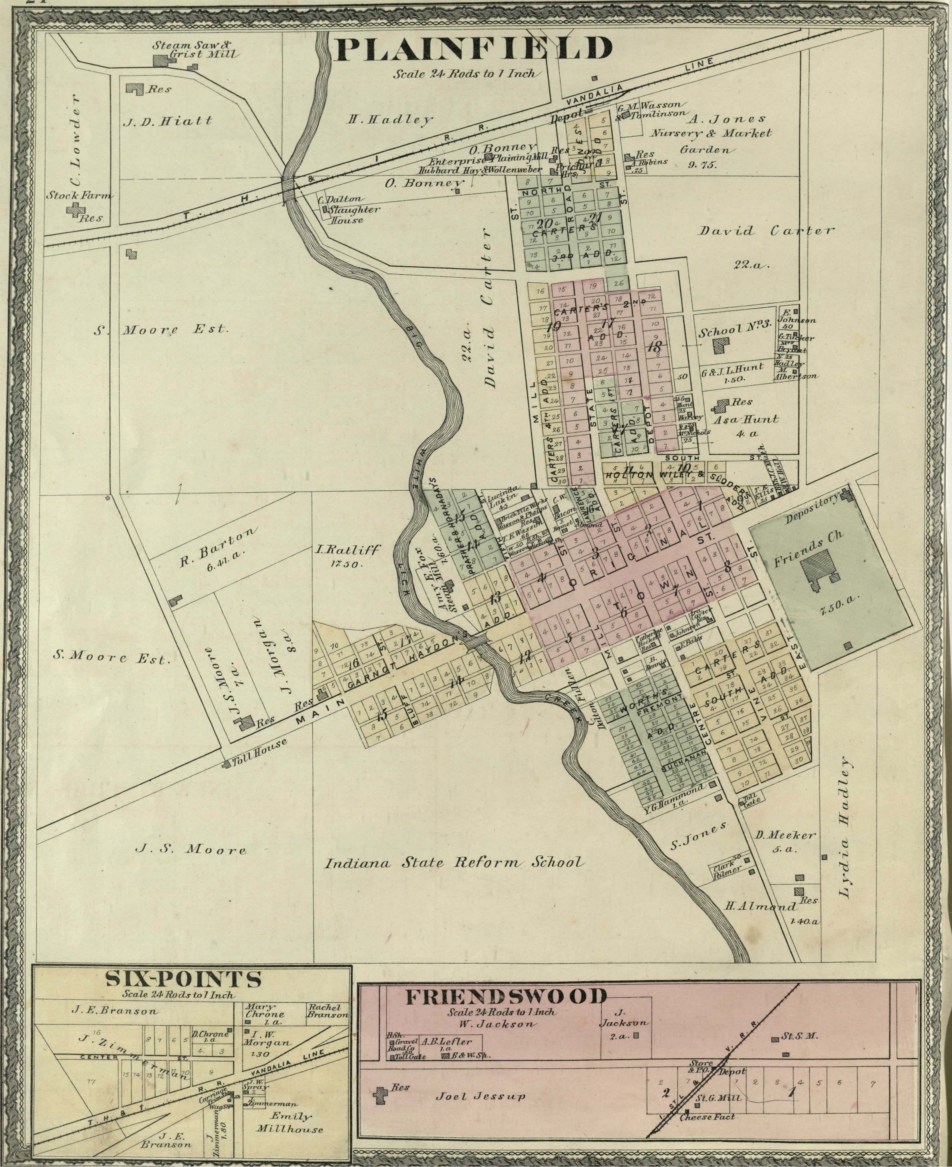
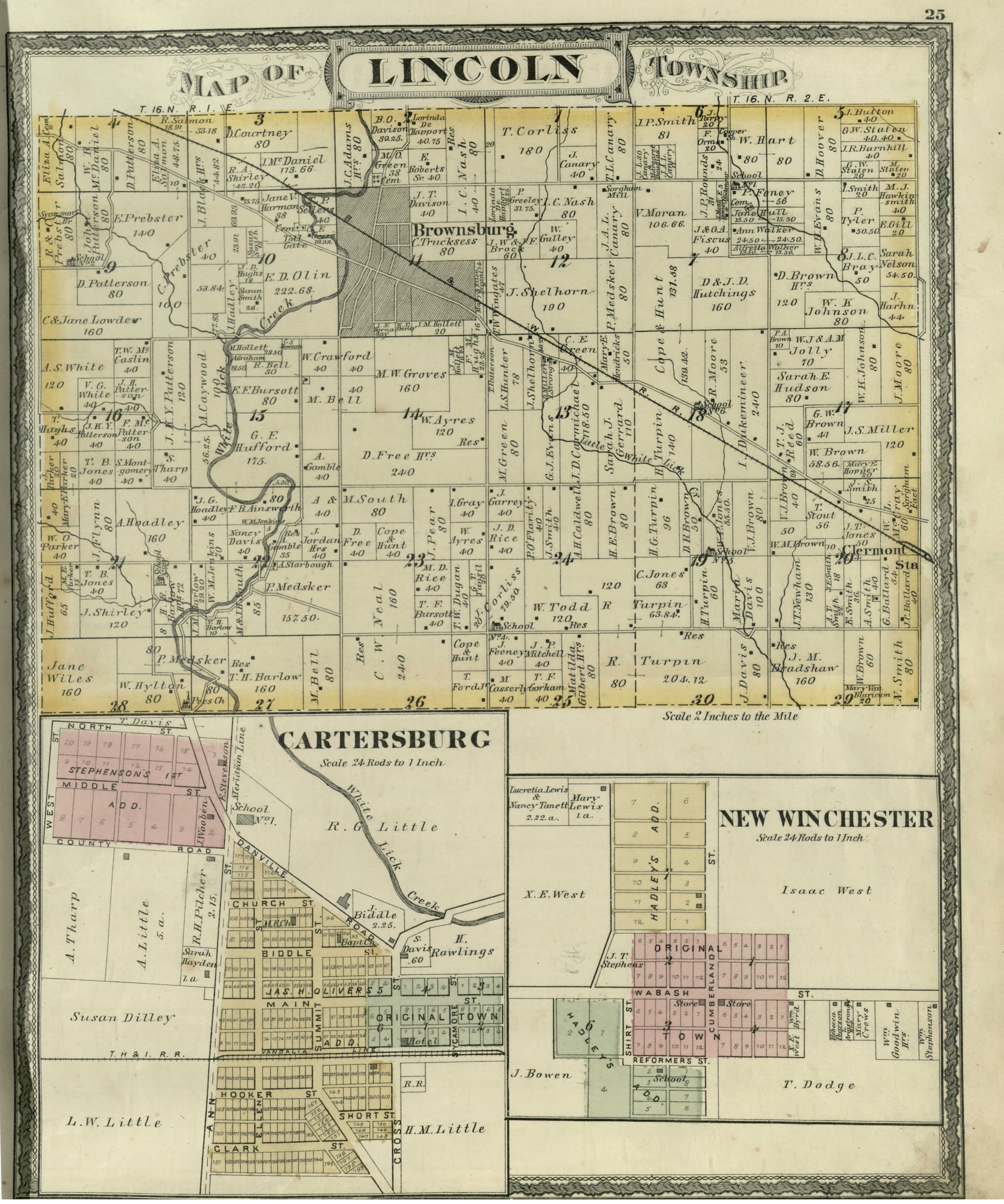
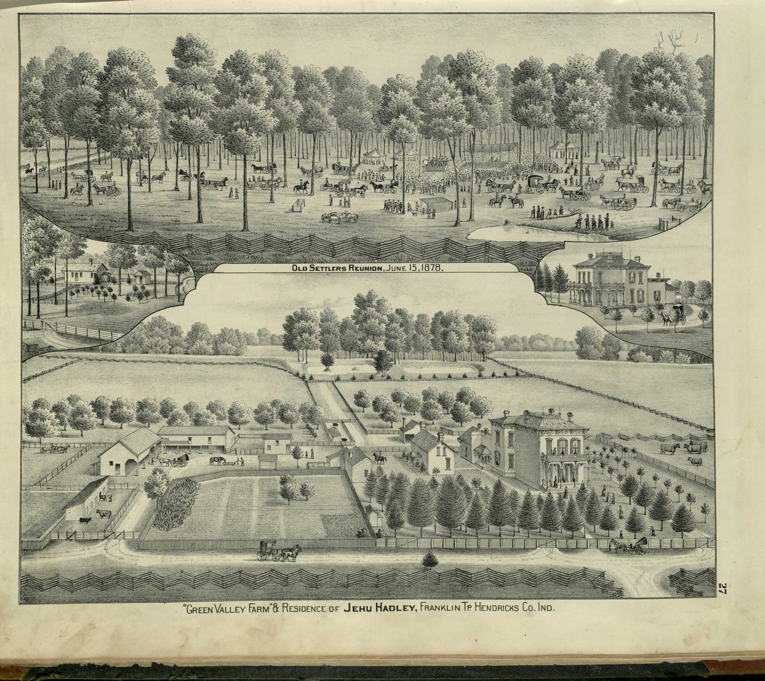
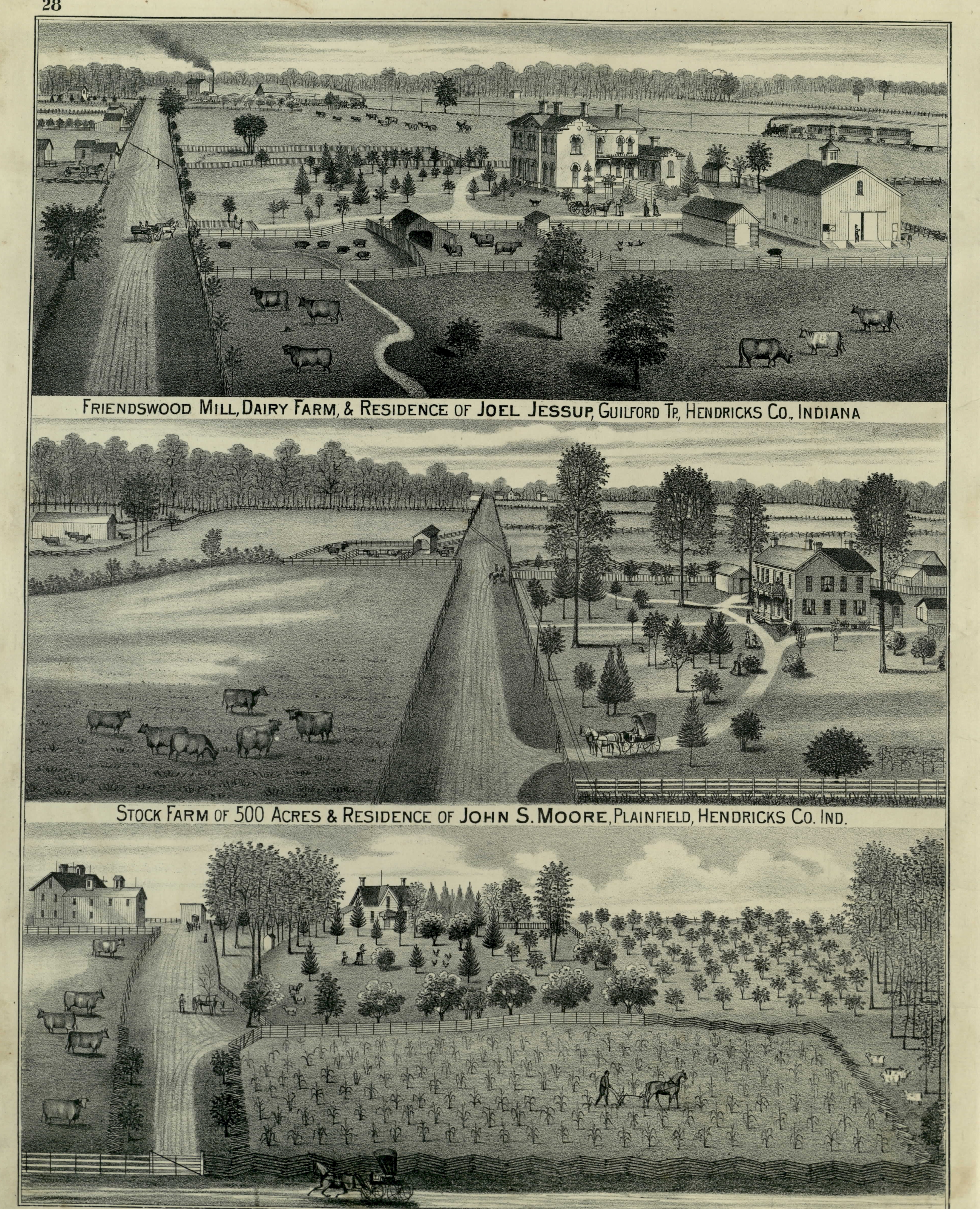
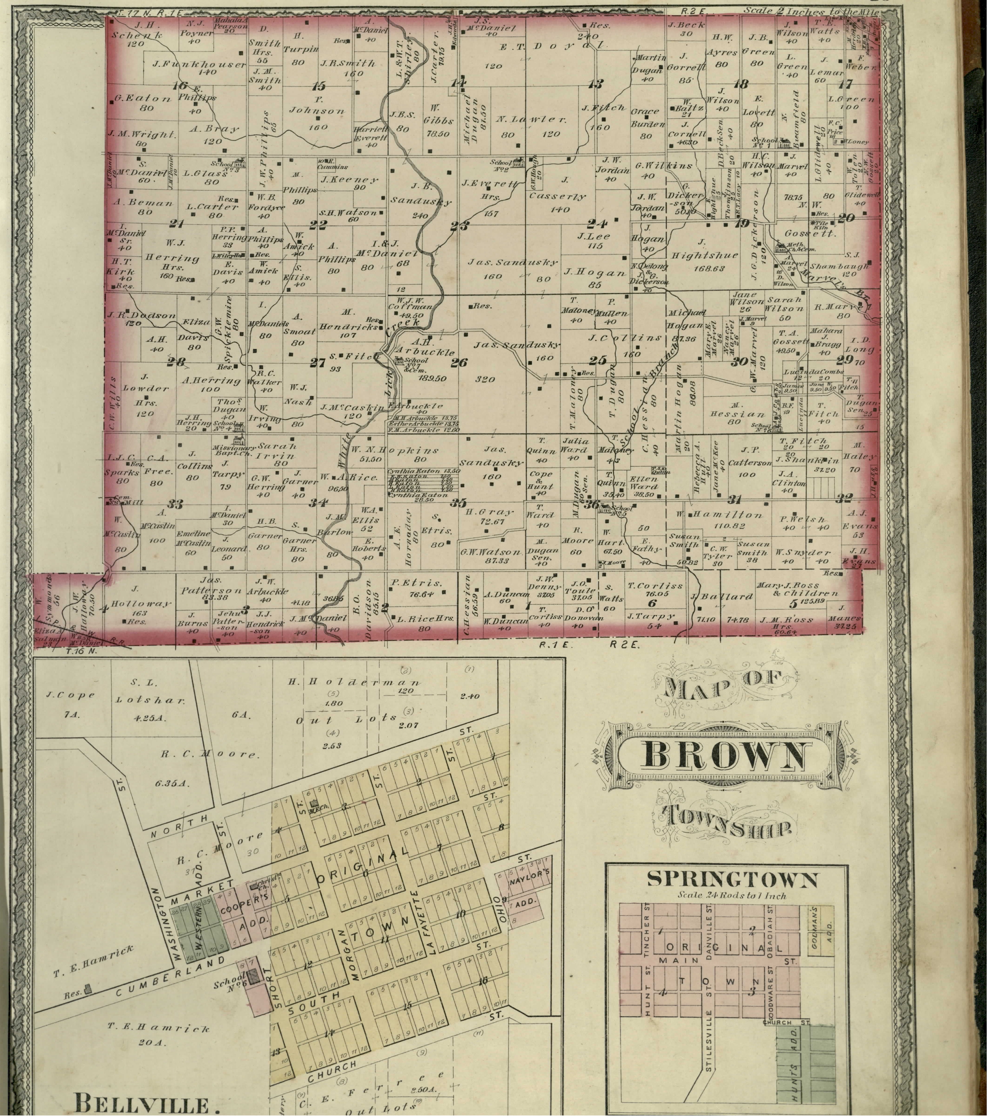
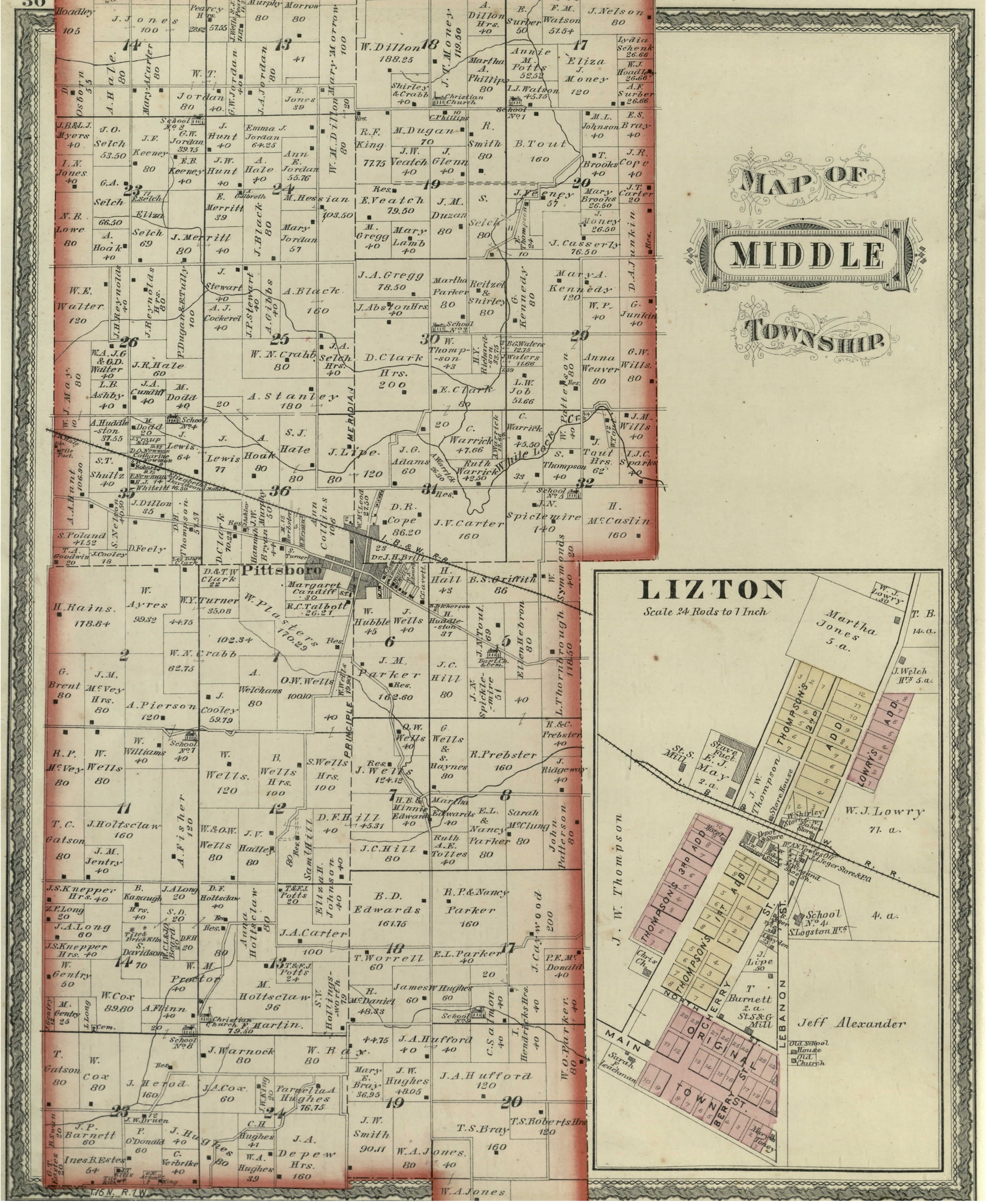
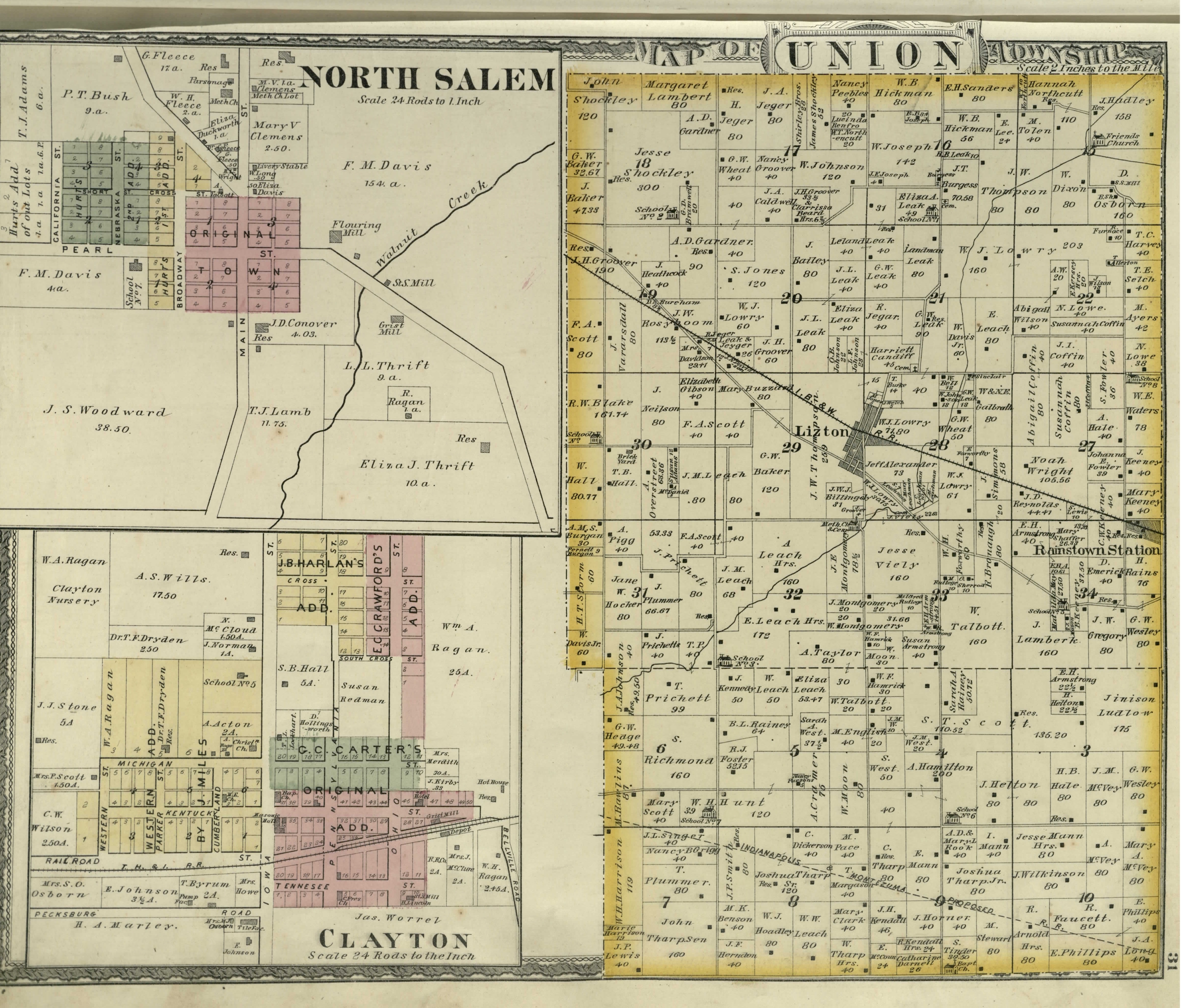
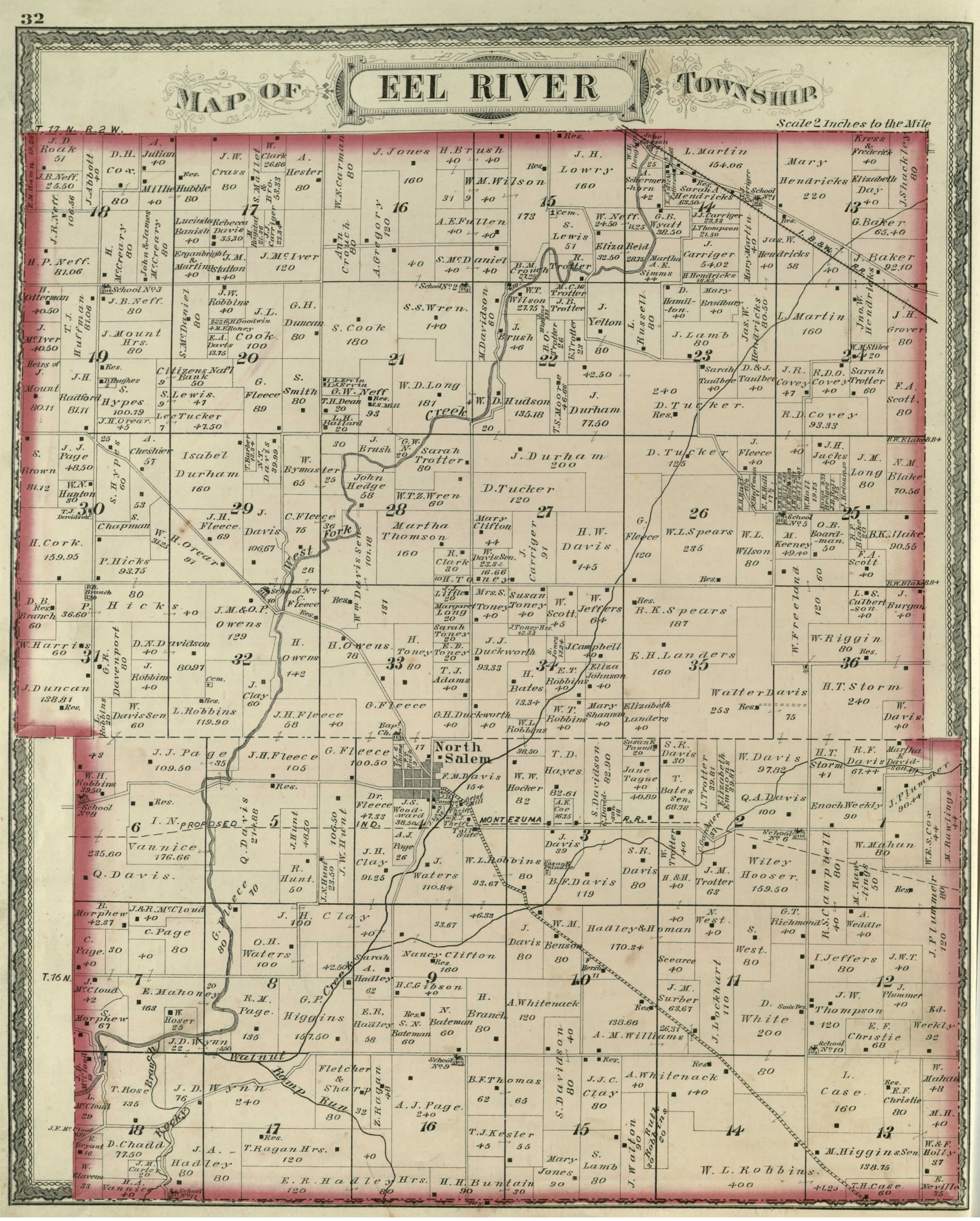
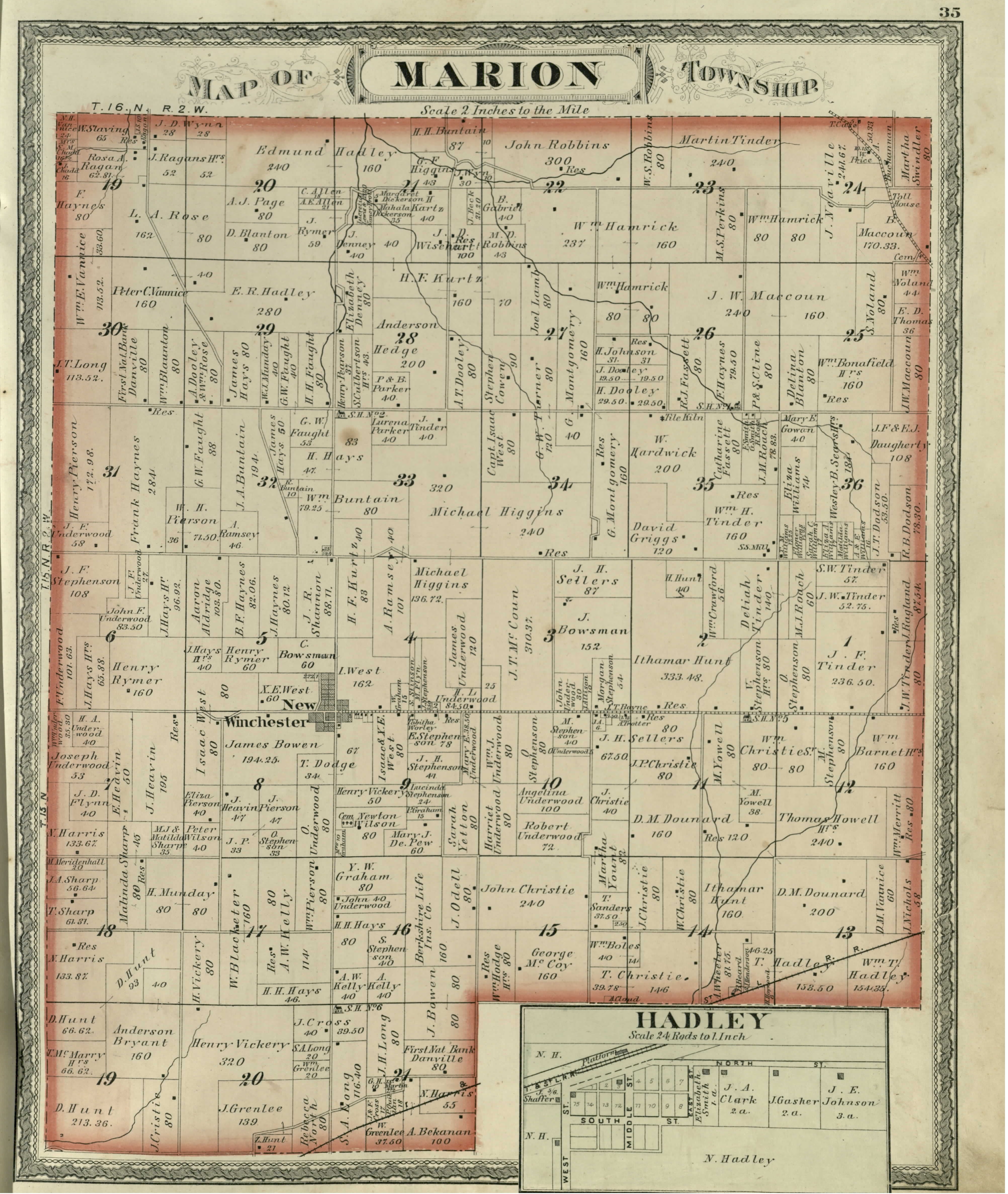
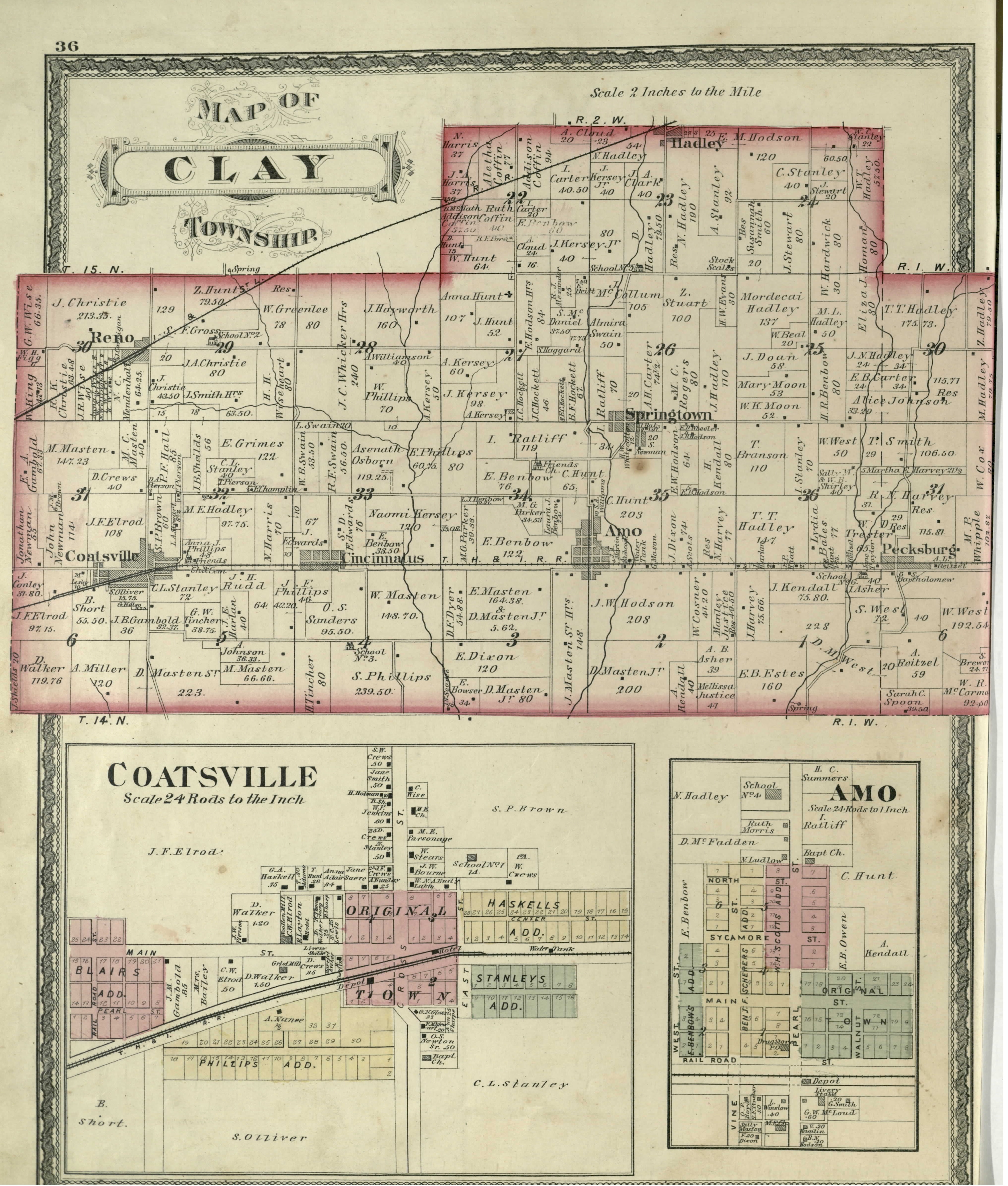
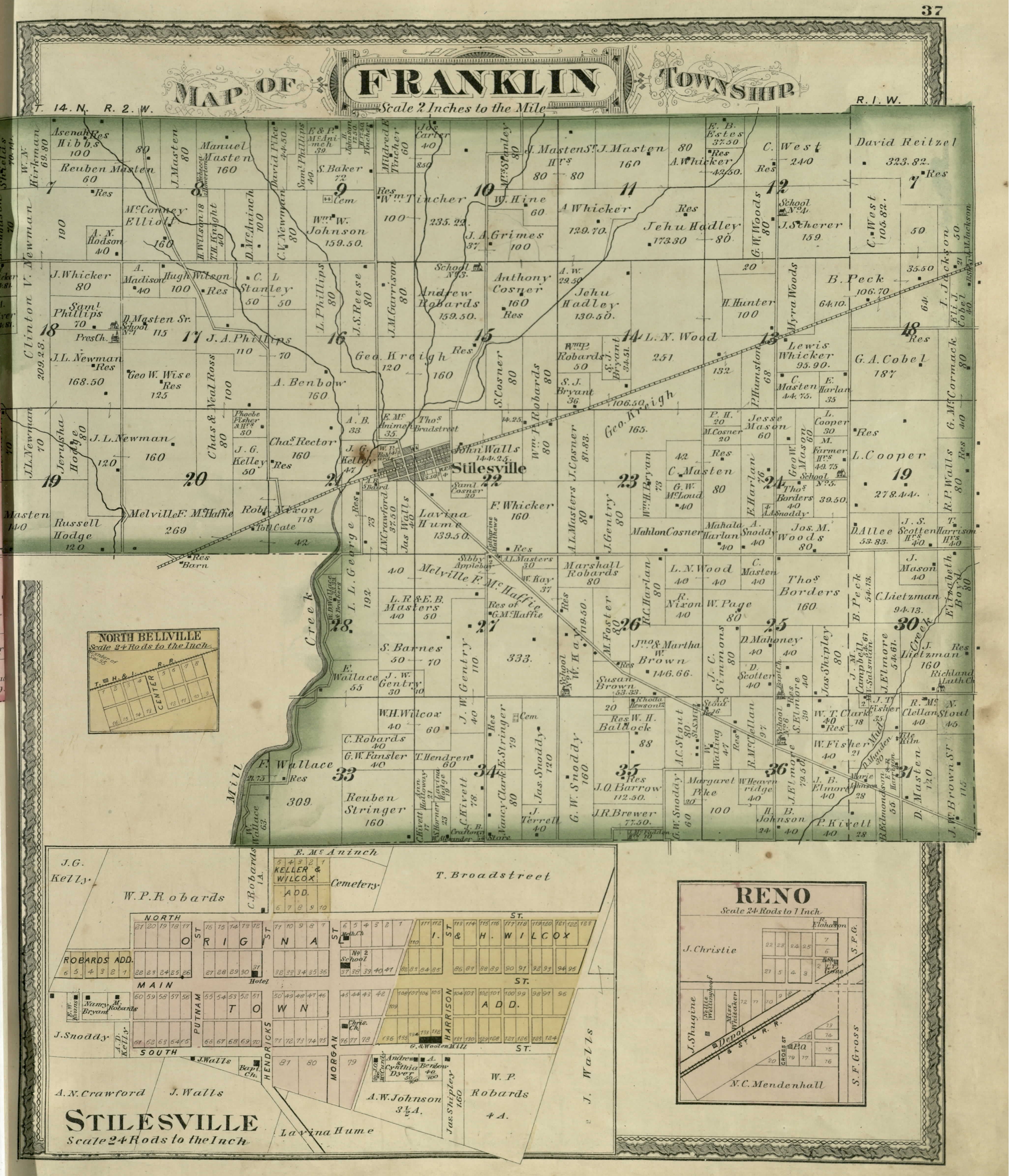
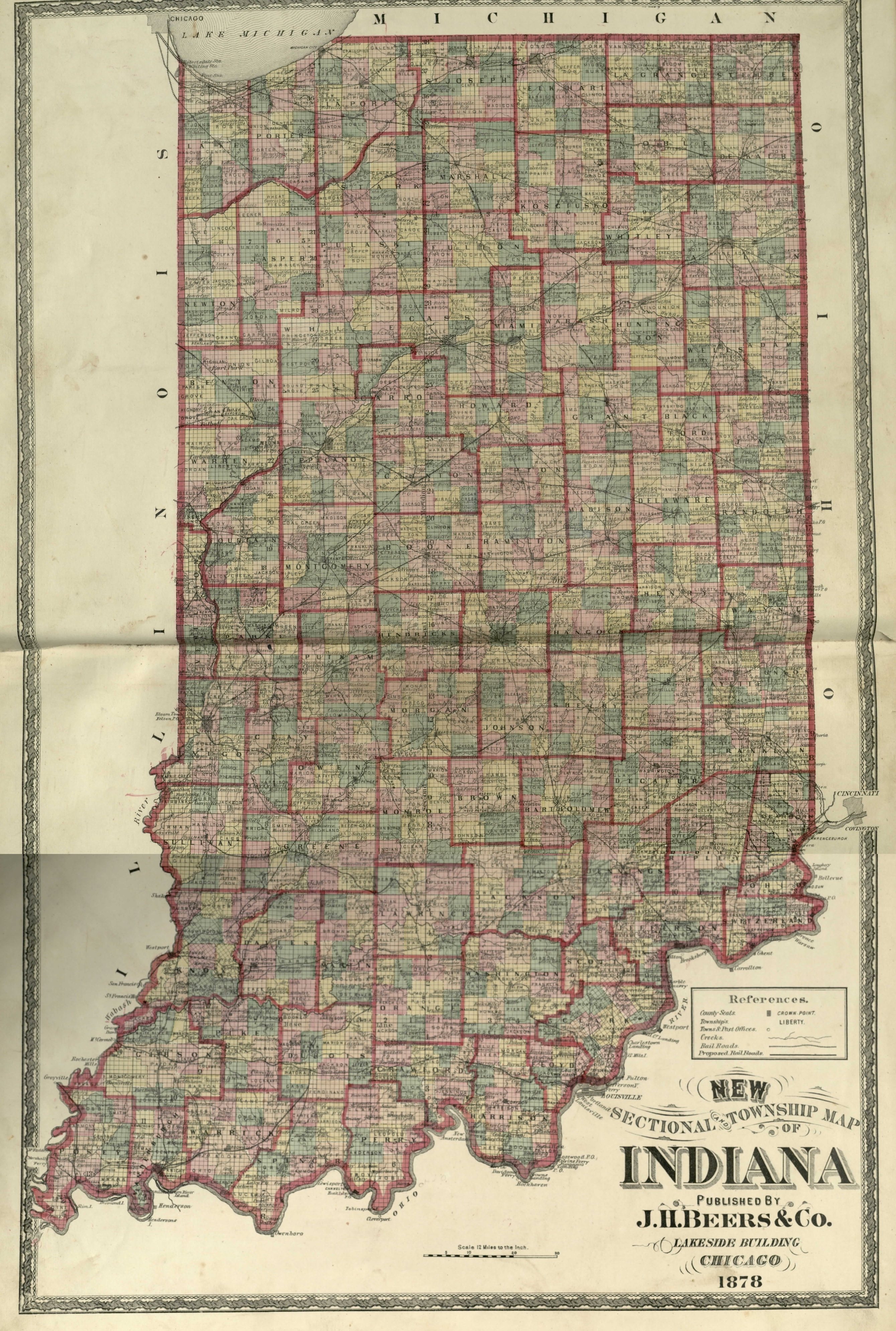
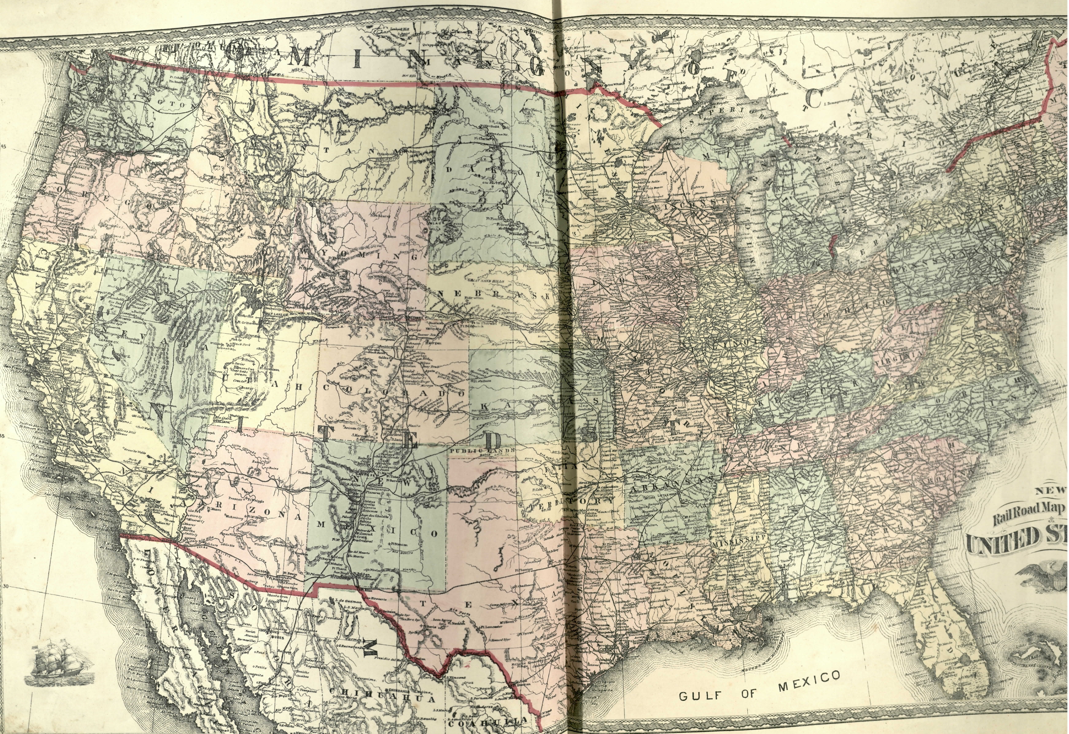
We have several historical maps of Hendricks County. As these maps are scanned, they will be presented here.
When you open these images, your browser may show the image at a decreased size.
Typically you can hover over the image and your browser will allow you to expand the image.
