Index to Historical Maps

page version = 3.0.02 , 05/30/2019 11:12:15 AM

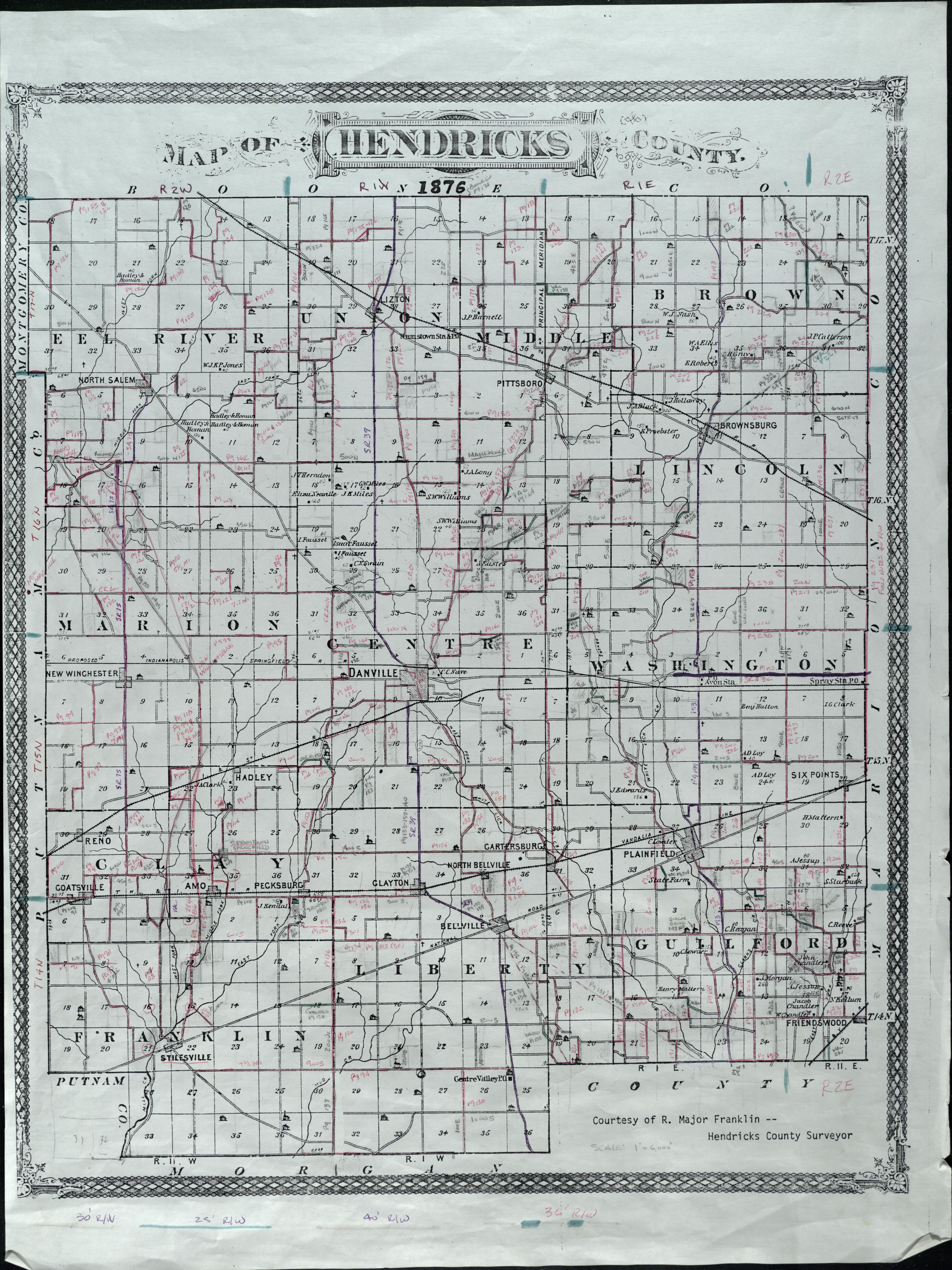
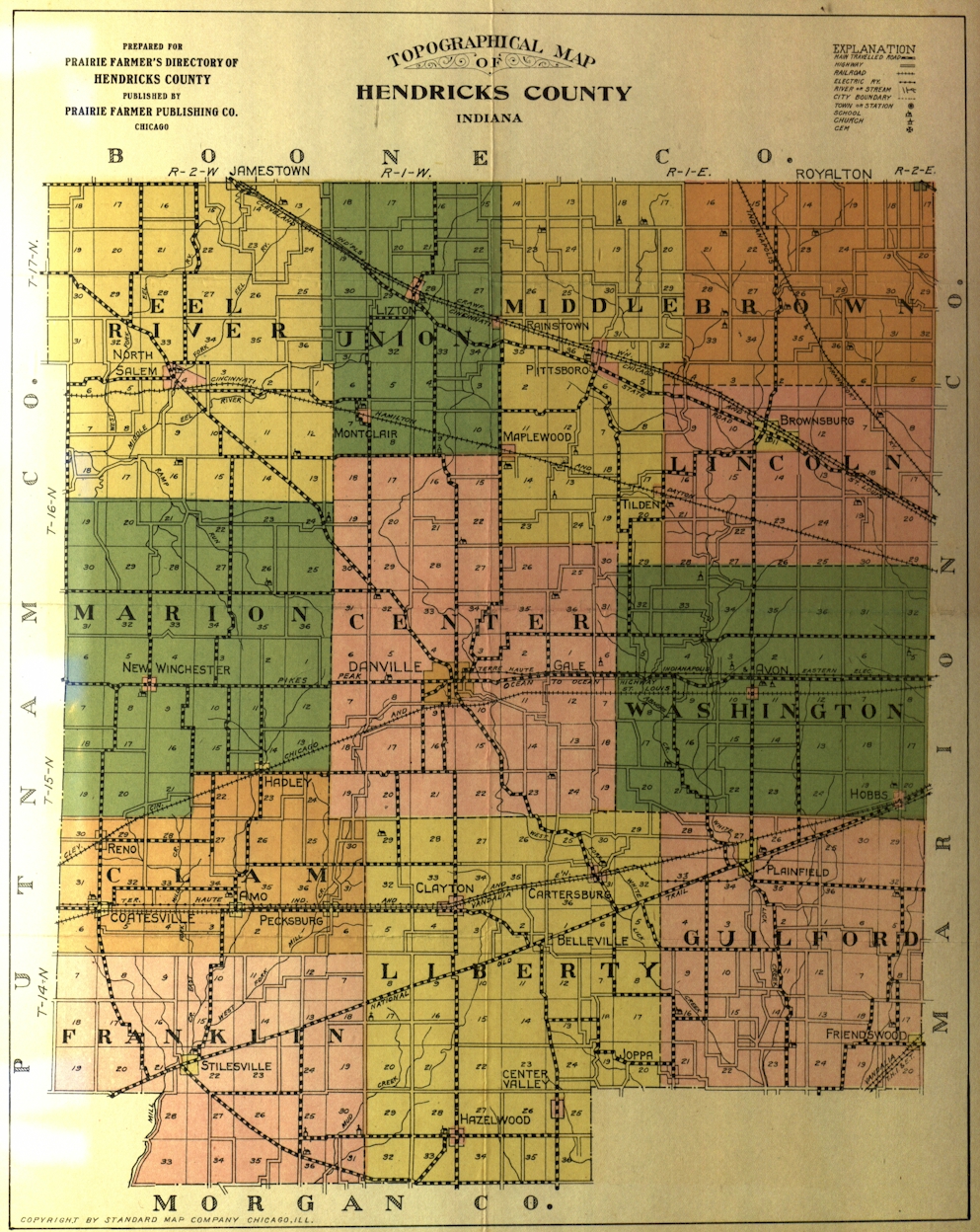
We have several historical maps of Hendricks County. As these maps are scanned, they will be presented here.
The images presented here are 1000 or more pixels wide. When you open these images, your browser may show the image at a decreased size.
Typically you can hover over the image and your browser will allow you to expand the image.
If you have a high resolution monitor, you may see the image at full size.
Some maps are very large, so we have scanned individual towns into separate images.
The links below go to a detailed index page, or in some cases, a single image.

Collection of county fire maps - PDF format. (published 01/14/2015)

Collection of Railroad maps - Index page. (published 01/14/2015)

1833 Hendricks County & State Map

1864 State Map

1865 Maps

1876 Hendricks County Map showing ancient roads

1878 Maps

1886 Danville Fire Map

1904 Maps and Documents

1907 Danville Fire Maps (published 01/09/2014)

1910 State Map (published 04/07/2016)

1916 Vandalia Railroad Maps (published 01/10/2014)

1916 County Map Calendar (published 04/07/2016)

1920 Hendricks County Map

1924 Maps

1929 Hendricks County Land Owners Map (published 01/10/2014)

1931 Morgan County Map

1932 Indiana Map (published 01/10/2014) (published 01/10/2014)

1937 County Map

1937 Highway Transportation Map

1942 Hendricks County Map

1946 Aerial Maps of the County

1947 Congressional Township Section Maps (published 01/24/2014)

1958 Aerial Maps of the County (published 10/03/2017)

1965 Land Owners Map (published 07/28/2014)

1970 Aerial Maps of the County (published 10/03/2017)

1971 Congressional Township Section Maps

1976 Hendricks County Map (published 01/10/2014)

1975 Hendricks County, Plainfield, Danville (published 04/07/2016)

1984 Aerial Maps of the County (published 09/29/2017)

1991 Aerial Maps of the County (published 04/09/2018)

   1991 Aerial Detail of Avon (published 04/09/2018)

   1991 Aerial Detail of Brownsburg (published 04/09/2018)

   1991 Aerial Detail of Plainfield (published 04/09/2018)

2000 Maps